You also want an ePaper? Increase the reach of your titles
YUMPU automatically turns print PDFs into web optimized ePapers that Google loves.
This was thought to be an indication to the location of the farms midden which could<br />
possibly contain useful comparative material for the research at Vatnsfjörður. Following<br />
some aguring work done on the site (see Dupont-Hébert C., this report) the decision was<br />
there fore made in <strong>2010</strong> to dig a test trench up against the erosion phase. Work was carried<br />
out by the archaeologist Hildur Gestsdóttir and took place on the 11 th of August. Postexcavation<br />
work was carried out by Oddgeir Isaksen.<br />
Description<br />
The erosion face is located on the western slope of the farm mound at Hálshús. It is about<br />
14 m long and 0.9 m high. The trench was 1 x 1 m in size and 1.2 m deep and was located<br />
up against the erosion face, about 5 m from its northern end. Two sections were recorded<br />
in the trench, the 2.12 m high west facing section and the 1.2 m high north facing section<br />
(Figure 3; Table 1). In addition the west facing section within the erosion surface above<br />
the test trench was cleaned.<br />
The overburden in the test trench was a 15 cm<br />
thick deposit of sheep dung, an indication that sheep<br />
have been seeking shelter there and probably aiding the<br />
erosion. This sealed a dark gray and firm deposit of<br />
flaky soil with bits of charcoal (unit [001]). Under<br />
deposit [001], was a lensed deposit [unit 024] of wood<br />
ash with charcoal as well as flecks of the H~1693<br />
tephra indicating that the deposit post-dates it (these<br />
units are only visible in the north facing section).<br />
The overburden seen in the west facing section<br />
consisted of a deposit of flaky soil which contained a<br />
lot of pieces of birch wood (unit [013]) on top of<br />
homogenous soil (unit [014]). This in turn sealed a<br />
sequence of grey wood ash lenses (unit [015]), about<br />
25 cm thick. Directly under [015] was a 5 cm thick silt<br />
deposit mixed with flecks of turf (unit [016]) and under<br />
that a thin deposit of black wood ash (unit [017]) about<br />
1 cm thick. Under deposit [017] came a sequence of<br />
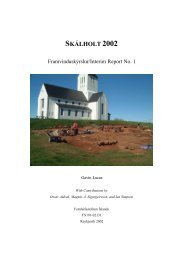
Figure 2. The test trench.<br />
Direction of camera, south-east<br />
three light brown to medium brown deposits (in<br />
chronological order, youngest to oldest: [018], [019]<br />
and [020]), with combined thickness of about 21 cm,<br />
which all contained birch chippings. All of them were<br />
composed of flaky soil but the earliest of them, unit [020], was also slightly mixed with<br />
fragments of turf. Deposit [020] was sitting directly on top of the H~1693 tephra in situ.<br />
The H~1693 tephra sealed a mixed deposit, about 9 cm thick, of turf debris and silt<br />
(unit [021]), which also contained some wood chippings. This was in turn sitting on top of<br />
a very compacted, about 10 cm thick, deposit of homogenous soil (unit [022]). Deposit<br />
[022] sealed a 8 cm thick deposit (unit [023]) of silt, slightly mixed with charcoal which<br />
was also the lowest unit exposed by the erosion face as (see figure 3).<br />
The north facing section showed clearly how the deposits were sitting on a rather<br />
steep slope (the west side of the farm mound) which dropped from east to west (see Figure<br />
3). Deposits [003] was thickest (11 cm) in the north facing section but became thinner, up<br />
slope to the east. It was mostly about 2 cm thick in the west facing section where it was<br />
clearly sealing a 20 cm thick lensed deposit (unit [025]) of firm, medium brown and orange<br />
turf, a possible turf wall. Also sealed by [003] but only visible in the north facing section<br />
77