Desire for Greener Land
Desire for Greener Land
Desire for Greener Land

You also want an ePaper? Increase the reach of your titles
YUMPU automatically turns print PDFs into web optimized ePapers that Google loves.
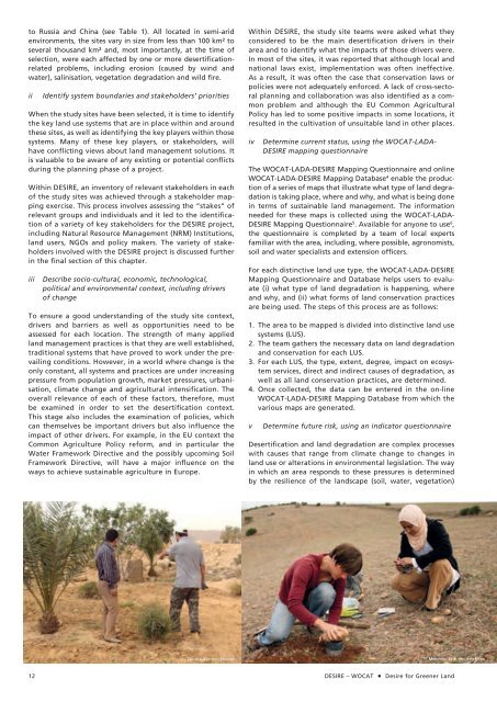
to Russia and China (see Table 1). All located in semi-arid<br />
environments, the sites vary in size from less than 100 km² to<br />
several thousand km² and, most importantly, at the time of<br />
selection, were each affected by one or more desertificationrelated<br />
problems, including erosion (caused by wind and<br />
water), salinisation, vegetation degradation and wild fire.<br />
ii Identify system boundaries and stakeholders’ priorities<br />
When the study sites have been selected, it is time to identify<br />
the key land use systems that are in place within and around<br />
these sites, as well as identifying the key players within those<br />
systems. Many of these key players, or stakeholders, will<br />
have conflicting views about land management solutions. It<br />
is valuable to be aware of any existing or potential conflicts<br />
during the planning phase of a project.<br />
Within DESIRE, an inventory of relevant stakeholders in each<br />
of the study sites was achieved through a stakeholder mapping<br />
exercise. This process involves assessing the “stakes” of<br />
relevant groups and individuals and it led to the identification<br />
of a variety of key stakeholders <strong>for</strong> the DESIRE project,<br />
including Natural Resource Management (NRM) Institutions,<br />
land users, NGOs and policy makers. The variety of stakeholders<br />
involved with the DESIRE project is discussed further<br />
in the final section of this chapter.<br />
iii Describe socio-cultural, economic, technological,<br />
political and environmental context, including drivers<br />
of change<br />
To ensure a good understanding of the study site context,<br />
drivers and barriers as well as opportunities need to be<br />
assessed <strong>for</strong> each location. The strength of many applied<br />
land management practices is that they are well established,<br />
traditional systems that have proved to work under the prevailing<br />
conditions. However, in a world where change is the<br />
only constant, all systems and practices are under increasing<br />
pressure from population growth, market pressures, urbanisation,<br />
climate change and agricultural intensification. The<br />
overall relevance of each of these factors, there<strong>for</strong>e, must<br />
be examined in order to set the desertification context.<br />
This stage also includes the examination of policies, which<br />
can themselves be important drivers but also influence the<br />
impact of other drivers. For example, in the EU context the<br />
Common Agriculture Policy re<strong>for</strong>m, and in particular the<br />
Water Framework Directive and the possibly upcoming Soil<br />
Framework Directive, will have a major influence on the<br />
ways to achieve sustainable agriculture in Europe.<br />
Within DESIRE, the study site teams were asked what they<br />
considered to be the main desertification drivers in their<br />
area and to identify what the impacts of those drivers were.<br />
In most of the sites, it was reported that although local and<br />
national laws exist, implementation was often ineffective.<br />
As a result, it was often the case that conservation laws or<br />
policies were not adequately en<strong>for</strong>ced. A lack of cross-sectoral<br />
planning and collaboration was also identified as a common<br />
problem and although the EU Common Agricultural<br />
Policy has led to some positive impacts in some locations, it<br />
resulted in the cultivation of unsuitable land in other places.<br />
iv Determine current status, using the WOCAT-LADA-<br />
DESIRE mapping questionnaire<br />
The WOCAT-LADA-DESIRE Mapping Questionnaire and online<br />
WOCAT-LADA-DESIRE Mapping Database 4 enable the production<br />
of a series of maps that illustrate what type of land degradation<br />
is taking place, where and why, and what is being done<br />
in terms of sustainable land management. The in<strong>for</strong>mation<br />
needed <strong>for</strong> these maps is collected using the WOCAT-LADA-<br />
DESIRE Mapping Questionnaire 5 . Available <strong>for</strong> anyone to use 6 ,<br />
the questionnaire is completed by a team of local experts<br />
familiar with the area, including, where possible, agronomists,<br />
soil and water specialists and extension officers.<br />
For each distinctive land use type, the WOCAT-LADA-DESIRE<br />
Mapping Questionnaire and Database helps users to evaluate<br />
(i) what type of land degradation is happening, where<br />
and why, and (ii) what <strong>for</strong>ms of land conservation practices<br />
are being used. The steps of this process are as follows:<br />
1. The area to be mapped is divided into distinctive land use<br />
systems (LUS).<br />
2. The team gathers the necessary data on land degradation<br />
and conservation <strong>for</strong> each LUS.<br />
3. For each LUS, the type, extent, degree, impact on ecosystem<br />
services, direct and indirect causes of degradation, as<br />
well as all land conservation practices, are determined.<br />
4. Once collected, the data can be entered in the on-line<br />
WOCAT-LADA-DESIRE Mapping Database from which the<br />
various maps are generated.<br />
v Determine future risk, using an indicator questionnaire<br />
Desertification and land degradation are complex processes<br />
with causes that range from climate change to changes in<br />
land use or alterations in environmental legislation. The way<br />
in which an area responds to these pressures is determined<br />
by the resilience of the landscape (soil, water, vegetation)<br />
Tunisia, Cyprien Hauser Morocco, Erik van den Elsen<br />
12 DESIRE – WOCAT <strong>Desire</strong> <strong>for</strong> <strong>Greener</strong> <strong>Land</strong>