work plan for soil remediation, sampling and analysis plan, site ...
work plan for soil remediation, sampling and analysis plan, site ...
work plan for soil remediation, sampling and analysis plan, site ...
You also want an ePaper? Increase the reach of your titles
YUMPU automatically turns print PDFs into web optimized ePapers that Google loves.
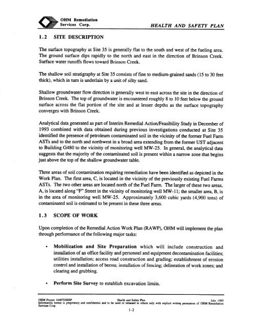
OHMRemediationServices Corp. HEALTH AND SAFETY PLAN1.2 SITE DESCRIPTIONThe surface topography at Site 35 is generally flat to the south <strong>and</strong> west of the fueling area.The ground surface dips rapidly to the north <strong>and</strong> east in the direction of Brinson Creek.Surface water runoffs flows toward Brinson Creek.The shallow <strong>soil</strong> stratigraphy at Site 35 consists of fiie to medium-grainedthick), which in turn is underlain by a unit of silty s<strong>and</strong>.s<strong>and</strong>s (15 to 30 feetShallow groundwater flow direction is generally west to east across the <strong>site</strong> in the direction ofBrinson Creek The top of groundwater is encountered roughly 8 to 10 feet below the groundsurface across the flat portion of the <strong>site</strong> <strong>and</strong> at lesser depths as the surface topographyconverges with Brinson CreekAnalytical data generated as part of Interim Remedial Action/Feasibility Study in December of1993 combined with data obtained during previous investigations conducted at Site 35identified the presence of petroleum contaminated <strong>soil</strong> in the vicinity of the <strong>for</strong>mer Fuel FarmASTs <strong>and</strong> to the north <strong>and</strong> northwest in a broad area extending from the <strong>for</strong>mer UST adjacentto Building G480 to the vicinity of monitoring well MW-25. In general, the analytical datasuggests that the majority of the contaminated <strong>soil</strong> is present within a narrow zone that beginsjust above the top of the shallow groundwater table.Three areas of <strong>soil</strong> contamination requiring <strong>remediation</strong> have been identified as depicted in theWork Plan. The first area, C, is located in the vicinity of the previously existing Fuel FarmsASTs. The two other areas are located north of the Fuel Farm. The larger of these two areas,A, is located along “F’ Street in the vicinity of monitoring well MW-11; the smaller area, B, isin the area of monitoring well MW-25. Approximately 3,600 cubic yards (4,900 tons) ofcontaminated <strong>soil</strong> is estimated to be present in these three areas.1.3 SCOPE OF WORKUpon completion of the Remedial Action Work Plan (RAWP), OHM will implement the <strong>plan</strong>through per<strong>for</strong>mance of the following major tasks:l Mobilization <strong>and</strong> Site Preparation which will include construction <strong>and</strong>installation of an office facility <strong>and</strong> personnel <strong>and</strong> equipment decontamination facilities;utilities installation; access road construction <strong>and</strong> grading; establishment of erosioncontrol <strong>and</strong> installation of berms; installation of fencing; delineation of <strong>work</strong> zones; <strong>and</strong>clearing <strong>and</strong> grubbing.l Per<strong>for</strong>m Site Survey to establish excavation limits.OHM Rojcct 16487SSHSP Hulth <strong>and</strong> Safety Plan July 1995In<strong>for</strong>mation herein is proprietary xnd aMidetttia1 md to be uSed 61 reltird lo others only with explicit writ+ permission of OHM Ran&&onServices Corp.l-2_-__-.


