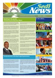
Chapter 11 - Sedibeng District Municipality
Chapter 11 - Sedibeng District Municipality
Chapter 11 - Sedibeng District Municipality

Create successful ePaper yourself
Turn your PDF publications into a flip-book with our unique Google optimized e-Paper software.
• The N1 national route running from Cape Tow n to Musina.<br />
• The N3 national route betw een Durban and Johannesburg. This route runs<br />
through Midvaal in the east.<br />
• The Golden Highw ay (R553) being a major north-south route w hich runs<br />
parallel to the N1 in the w est of <strong>Sedibeng</strong> and past Sebokeng and Evaton.<br />
• The R59 north-south route w hich links Alberton and Vereeniging and runs<br />
through the east of Midvaal past Meyerton.<br />
• The R82 north-south route w hich links Johannesburg and Vereeniging via<br />
Walkerville and De Deur in the w est of Midvaal.<br />
• The K89 being a secondary route running parallel to the R59 linking Alberton<br />
and Vereeniging through Meyerton. This w as the main route until the R59<br />
freeway was constructed.<br />
• The R42 being an east-w est route which links Meyerton w ith Heidelberg and<br />
the N17 in Ekurhuleni.<br />
• The R551 being an east-w est route between the N1 and the Suikerbosrand<br />
Nature Reserve. This road merges w ith the R42 at the Nature Reserve.<br />
• The R550 being an east-w est link betw een the N3, R59 and R82.<br />
• The R54 w hich links Vaal Marina in the south of Midvaal w ith the R82.<br />
Most of the existing north-south linkages in the region are provided through high order<br />
roads, such as freeways, while the east-w est routes are mainly low er order routes.<br />
The overall condition of the higher order road netw ork in the region is good.<br />
The R59 is the highest order road and functions as a Mobility Route linking the grow th<br />
points of Alberton and Vereeniging w ith access limited to specific intersections on this<br />
route. These are:<br />
• K86 intersection (Kliprivier Drive) in Alberton;<br />
• K154 (R550) intersection at Nampak and Everite;<br />
• K158 intersection at Daleside;<br />
• Henley-on-Klip off-ramp;<br />
• K210 (Meyer Street) off ramp at Meyerton;<br />
• K164 (Johan le Roux Street) off ramp at Meyerton industrial area; and<br />
• K<strong>11</strong> (Verwoerd Street) off ramp at Rothdene.<br />
These intersections are relatively evenly spaced along the length of this spine and<br />
provide direct connections w ith the K89. The proposed PWV 18 and PWV 20 w ill als o<br />
intersect the R59 in the north and south respectively.<br />
Route K89 runs more or less parallel to the R59 freew ay and w ill thus in future act as<br />
an Activity Spine w hich w ill unlock the development potential of the land parallel to<br />
the east of the freew ay in future. As this w as originally the only road through the<br />
area, most of the land uses occurred along this road and front onto this road. Route<br />
K89 has low er mobility than the R59 freew ay, but higher accessibility through more<br />
intersections and direct access at spacing intervals of about 600 metres. The<br />
upgrading of the current road to the standards of a K route w ill how ever have the<br />
effect that no direct access to land uses will be possible from this road in future. The<br />
construction of an additional low er order (third and fourth order) road network around<br />
the corridor to supplement the K89 and provide direct access to land uses along the<br />
R59 freew ay will thus be required.<br />
Due to the high development pressure experienced in the area, there is currently an<br />
initiative underw ay to design a third and fourth order road netw ork for the R59<br />
SDM DITP, 2008 to 2013 96 31 Aug 2010