Chapter 11 - Sedibeng District Municipality
Chapter 11 - Sedibeng District Municipality
Chapter 11 - Sedibeng District Municipality

You also want an ePaper? Increase the reach of your titles
YUMPU automatically turns print PDFs into web optimized ePapers that Google loves.
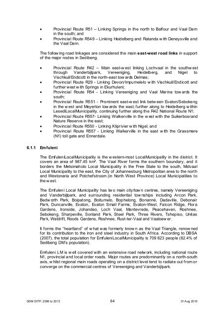
• Provincial Route R51 – Linking Springs in the north to Balfour and Vaal Dam<br />
in the south; and<br />
• Provincial Route R549 – Linking Heidelberg and Ratanda w ith Deneysville and<br />
the Vaal Dam.<br />
The follow ing road linkages are considered the main east-west road links in support<br />
of the major nodes in <strong>Sedibeng</strong>.<br />
• Provincial Route R42 – Main east-w est linking Lochvaal in the southw est<br />
through Vanderbijlpark, Vereeniging, Heidelberg, and Nigel to<br />
Vischkuil/Endicott in the north-east tow ards Delmas;<br />
• Provincial Route R29 - Linking Devon/Impumelelo w ith Vischkuil/Endicott and<br />
further west w ith Springs in Ekurhuleni;<br />
• Provincial Route R54 - Linking Vereeniging and Vaal Marina tow ards the<br />
south;<br />
• Provincial Route R551 - Prominent east-w est link betw een Evaton/Sebokeng<br />
in the w est and Meyerton tow ards the east, further along to Heidelberg w ithin<br />
LesediLocal<strong>Municipality</strong>, continuing further along the R42 National Route N1;<br />
• Provincial Route R557- Linking Walkerville in the w est with the Suikerbosrand<br />
Nature Reserve in the east;<br />
• Provincial Route R550 - Linking Kliprivier w ith Nigel; and<br />
• Provincial Route R557 - Linking Walkerville in the east w ith the Grassmere<br />
(N1) toll gate and Ennerdale.<br />
6.1.1 Emfuleni<br />
The EmfuleniLocal<strong>Municipality</strong> is the w estern-most Local<strong>Municipality</strong> in the district. It<br />
covers an area of 987.45 km². The Vaal River forms the southern boundary, and it<br />
borders the Metsimaholo Local <strong>Municipality</strong> in the Free State to the south, Midvaal<br />
Local <strong>Municipality</strong> to the east, the City of Johannesburg Metropolitan area to the north<br />
and Westonaria and Potchefstroom (in North West Province) Local Municipalities to<br />
the w est.<br />
The Emfuleni Local <strong>Municipality</strong> has tw o main city/tow n centres, namely Vereeniging<br />
and Vanderbijlpark, and surrounding residential tow nships including Arcon Park,<br />
Bedw orth Park, Boipatong, Boitumelo, Bophelong, Bonanné, Dadaville, Debonair<br />
Park, Duncanville, Evaton, Evaton Small Farms, Evaton-West, Falcon Ridge, Flora<br />
Gardens, Ironside, Johandeo, Loch Vaal, Mantevrede, Peacehaven, Roshnee,<br />
Sebokeng, Sharpeville, Sonland Park, Steel Park, Three Rivers, Tshepiso, Unitas<br />
Park, Waldrift, Roods Gardens, Roshnee, Rust-ter-Vaal and Vaaloew er.<br />
It forms the “heartland” of w hat was formerly know n as the Vaal Triangle, renow ned<br />
for its contribution to the iron and steel industry in South Africa. According to DBSA<br />
(2007), the total population for EmfuleniLocal<strong>Municipality</strong> is 709 823 people (82.4% of<br />
<strong>Sedibeng</strong> DM’s population).<br />
Emfuleni LM is w ell covered with an extensive road netw ork, including national route<br />
N1, provincial and local order roads. Major routes are predominantly on a north-south<br />
axis, w hilst regional main roads operating on a district level tend to radiate out from or<br />
converge on the commercial centres of Vereeniging and Vanderbijlpark.<br />
SDM DITP, 2008 to 2013 64 31 Aug 2010