GSC Sentinel-2 PDGS OCD - Emits - ESA
GSC Sentinel-2 PDGS OCD - Emits - ESA
GSC Sentinel-2 PDGS OCD - Emits - ESA

Create successful ePaper yourself
Turn your PDF publications into a flip-book with our unique Google optimized e-Paper software.
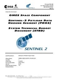
<strong>GSC</strong> <strong>Sentinel</strong>-2 <strong>PDGS</strong> <strong>OCD</strong><br />
Issue 1 Revision 2 (draft) - 25.07.2010<br />
GMES-GSEG-EOPG-TN-09-0008<br />
page 339 of 350<br />
A.6 DAP-R Analysis Table<br />
The following table summarises the requirement of each service in terms of product semantics and access characteristics. A<br />
<strong>Sentinel</strong>-2 equivalent volume estimate is provided for reference for the volume computations (linked to the mapping frequency).<br />
Service<br />
Area<br />
Processing<br />
Level<br />
Ortho Accuracy<br />
Cloud<br />
Coverage Tasking Mapping<br />
Frequency<br />
Size of<br />
L1C<br />
Compr.<br />
Data<br />
[Gbyte]<br />
Delivery<br />
INFO<br />
LAND AND TERRESTRIAL SERVICE<br />
LMCS_001 – EEA-38 wall-towall<br />
coverage<br />
EEA-38 + associated<br />
countries 5.8 million km2<br />
L1B, L3<br />
(orthorectified<br />
& satellite<br />
reflectance)<br />
yes 1/2 pixel < 5% Predefined<br />
LMCS_009 – High Risk Areas 6000 km2 L1B yes 1/3 pixel Predefined<br />
LMCS_010 – Agroenvironmental<br />
analysis<br />
LMCS_012a – Europe land cover<br />
of forests, HR coverage<br />
LMCS_003 – Seasonal/annual<br />
land change monitoring: Africa<br />
selected areas (HR)<br />
LMCS_006c – Selected sites for<br />
validation of MR and LR<br />
biophysical products<br />
LGSE_001 – Global Monitoring<br />
Food Security: Crop mapping:<br />
Africa selected areas (HR)<br />
LGSE_003 – Forest Monitoring:<br />
REDD<br />
EEA-38 demonstration sites<br />
73000 km2<br />
European selectes sites<br />
170000 km2<br />
L1B No 1/3 pixel Predefined<br />
L1B, L3<br />
(orthorectified<br />
& satellite<br />
reflectance)<br />
Every 3 Years - 2<br />
coverages during<br />
vegetation season<br />
Annually or 3 to 4<br />
per Year<br />
Annually or 3 to 4<br />
per Year<br />
290<br />
Normal for<br />
archive data<br />
Wall-to-wall land-cover mapping at European scale for implementation, review and<br />
monitoring of EU policies (e.g. water framework directive, biodiversity strategy,<br />
common agricultural, regional policies) and also for reporting obligations under<br />
international treaties (e.g. the Kyoto Protocol), in line with national land-cover /<br />
landuse<br />
inventories in the Member States. SAR data may be used as backup. Reference<br />
year 2009. Baseline: 2 data takes during vegetation season in reference year<br />
0.3 1-7 Days EU High Risks Areas. 4 data takes during vegetation season in reference year<br />
3.65 once Normal<br />
yes 1/2 pixel < 5% Predefined Every 3-5 years 8.5 Normal Coverage of Europe’s main forest areas<br />
Africa selected areas L1B yes 1/3 pixel < 5% Predefined Every year<br />
European selected areas<br />
3600 km2<br />
Africa: National coverage at<br />
MR and selected areas at HR<br />
of the following<br />
countries: Mozambique,<br />
Malawi, Zimbabwe,<br />
Ethiopia, Senegal and Sudan<br />
Areas in the tropical belt<br />
2-3 millions km2<br />
Spot View<br />
ortho<br />
500 per<br />
Year<br />
Normal<br />
yes 1/2 pixel < 10% Predefined Monthly 0.2 Normal<br />
L1B yes 1/3 pixel Predefined<br />
Yearly, new HR<br />
should be acquired<br />
every growing<br />
season<br />
L1B/C yes 1/3 IFOV Predefined<br />
One historical and<br />
one actual coverage<br />
(national / large<br />
regional) during<br />
dry season<br />
200 Normal<br />
150 Normal<br />
Environmental seasonal / annual change monitoring in development upon request<br />
from the user DGs (DEV, AIDCO, RELEX - plus high-resolution information on<br />
sites selected according to a statistically valid Area Frame Sampling scheme (AFS),<br />
as well as for hot-spot analysis.<br />
Selected sites among those identified by the Land Product Validation sub-group of<br />
CEOS for the validation of LR and MR biogeophysical parameters.<br />
Medium and high resolution crop mapping upon request from national and<br />
international users (FAO, WFP, Ministries of agriculture) - plus very high-resolution<br />
information on sites whereby field information cannot be collected<br />
Reduction of emissions from deforestation in developing countries for UNFCCC:<br />
300 – 500 HR – VHR scenes over tropical countries for large area coverage. In<br />
addition medium and low resolution multi-seasonal acquisitions to fill holes due to<br />
cloud coverage. Archived (40%) and newly (60%) acquired scenes,<br />
200 – 300 HR SAR images<br />
<strong>ESA</strong> UNCLASSIFIED – For Official Use © <strong>ESA</strong><br />
The copyright of this document is the property of <strong>ESA</strong>. It is supplied in confidence and shall not be reproduced, copied or<br />
communicated to any third party without written permission from <strong>ESA</strong>.