Evaluating Alternative Operations Strategies to Improve Travel Time ...
Evaluating Alternative Operations Strategies to Improve Travel Time ...
Evaluating Alternative Operations Strategies to Improve Travel Time ...

You also want an ePaper? Increase the reach of your titles
YUMPU automatically turns print PDFs into web optimized ePapers that Google loves.
SHRP 2 L11: Final Appendices<br />
Additional Description of <strong>Strategies</strong><br />
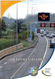
Information Collection and Dissemination<br />
2.1. Surveillance and Detection<br />
A variety of surveillance and detection technologies are able <strong>to</strong> detect incidents quickly. These<br />
include inductive loops, acoustic and microwave vehicle detec<strong>to</strong>rs, and camera systems that<br />
provide frequent still images or full-motion video. These ITS technologies help incident<br />
management personnel identify incidents shortly after they happen. Surveillance and detection<br />
solutions along a corridor or within a region can provide considerable long-term benefits and are<br />
critical elements for establishing a nationally available, real-time traffic and travel conditions<br />
moni<strong>to</strong>ring system (9).<br />
Additionally, reducing annual road accidents and deaths requires more than improved vehicle and<br />
roadway technologies. Surveillance treatments also include evaluating the capability of drivers <strong>to</strong><br />
safely operate a mo<strong>to</strong>r vehicle in the short and long terms. Driver behavior such as speeding,<br />
reckless driving, and alcohol or drug use are typically addressed and closely moni<strong>to</strong>red by law<br />
enforcement authorities. Behavioral interventions such as stricter crackdowns on impaired driving,<br />
additional restrictions on high-risk drivers and au<strong>to</strong>mated enforcement (10) have proved successful<br />
in other nations<br />
2.2. Probe Vehicles and Point Detection<br />
Probe Vehicles and Point Detection (GPS, Video Detection, Radar, Transponders, Blue<strong>to</strong>oth<br />
MAC Readers)—Doppler radar, video image processors (VIP) and Global Positioning System<br />
(GPS) are technology devices that are used by roadway agencies for vehicle detection in order <strong>to</strong><br />
provide near-real-time travel time estimation. The application of each technology varies among<br />
agencies according <strong>to</strong> agencies’ knowledge of each technology (11).<br />
Doppler radar works by measuring changes in frequency and wavelength of moving targets. This<br />
sensor is usually installed on a pole or a mast along the roadway and is capable of detecting speed<br />
of vehicles moving <strong>to</strong>ward or away from the radar. Doppler radar provides direct speed<br />
measurements, and is typically insensitive <strong>to</strong> inclement weather.<br />
A VIP system typically consists of one or more cameras mounted on a pole, a microprocessorbased<br />
computer for digitizing and processing the imagery, and software for interpreting the images<br />
and converting them <strong>to</strong> traffic flow data. VIP systems are able <strong>to</strong> moni<strong>to</strong>r multiple detection zones<br />
and provide information on several aspects of travel data (e.g., speed, volume and vehicle length).<br />
Rain, snow, and wind gusts are known <strong>to</strong> affect sensor performance. Vehicle shadows and<br />
occlusions are other weaknesses of VIP systems.<br />
GPS is a worldwide tracking system based on satellites that orbit the earth. GPS receivers are able<br />
<strong>to</strong> establish a vehicle’s position, speed, and direction based on satellite information. Continuous<br />
vehicle position information is provided because vehicle direction and speeds are measured in real<br />
time. The receiver is usually placed inside the vehicle and a dedicated data link (e.g. wireless or<br />
cell phone network) is required <strong>to</strong> identify vehicle direction of travel and speed. GPS receivers<br />
need <strong>to</strong> have a clear sky <strong>to</strong> receive signals from the satellite system, and the connection can be lost<br />
when vehicles travel through tunnels, mountains, trees, etc.<br />
ADDITIONAL DESCRIPTION AND QUANTITATIVE BENEFITS OF TRAVEL-TIME RELIABILITY STRATEGIES Page F-2