
Create successful ePaper yourself
Turn your PDF publications into a flip-book with our unique Google optimized e-Paper software.
Summary<br />
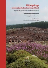
In anticipation of the construction of a new stretch of the<br />
E18 motorway between Örebro and Karlskoga, an archaeological<br />
investigation was carried out on an ancient site<br />
(RAÄ 84: 1-2) at Västra Via, Vintrosa parish, in the province<br />
of Närke (Örebro County). The excavation was conducted<br />
by the Societas Archaeologica Upsaliensis (<strong>SAU</strong>)<br />
from June 7 to November 3, 2005, following a decision<br />
from the County Administrative Board of Örebro County<br />
(Act No 431-04813-2005).<br />
Västra Via lies on the north boundary of the Närke<br />
Plain, where this gives way to forest land on the Eastern<br />
slope of the Latorp plateau. Encompassing approximately<br />
27 000 square metres, the investigated area was situated<br />
on a moraine height, in parts fairly rocky, with an elevation<br />
of 60 to 66 m. a. s. l.<br />
The investigated area has been tilled in historical times.<br />
There were several clearage cairns, many consisting of<br />
cleared stone deposited around central boulders. Adjacent<br />
to the southern part of the investigated area is the<br />
village of Västra Via, which has medieval origins.<br />
The topsoil throughout the entire investigated area<br />
was removed with an excavator. A total of 3282 archaeological<br />
features where surveyed, and a majority of these<br />
were documented. In the culture layers that were found, a<br />
total of 294 test pits were dug. Layers were scanned with a<br />
metal detector. In five layers there were finds of a prehistoric<br />
character, while one layer contained post-reformation<br />
objects.<br />
The results of the investigations showed that Västra<br />
Via had traces of human activity dating from most of the<br />
pre-historic era. Most features were linked to settlement<br />
activity, including postholes of varying sizes, pits and<br />
hearths. Constructions found included 22 three-aisled<br />
post houses, two pit houses, two stone foundations and<br />
nine fences. Typologically, the houses dated from the Late<br />
Bronze Age to the Migration Period. Most houses were<br />
relatively small, and were probably traces of a single farm,<br />
repeatedly relocated within the area.<br />
Also, seven iron production furnaces where found,<br />
dating from the Vendel Period to the Viking Age. The<br />
furnaces were grouped together within a small area surrounded<br />
by a culture layer containing large quantities of<br />
slag and burnt clay. Analysis of material from the furnaces<br />
showed that iron of various qualities was produced on the<br />
site. There were no traces of secondary smithing. The two<br />
pit houses were located close by, and one of these dated<br />
from the Vendel Period.<br />
The stone foundations, which had not been part of<br />
dwellings, were located in the peripheral parts of the<br />
investigated area, adjacent to the medieval village toft.<br />
They did not appear on any of the historical maps, and<br />
presumably belonged to a phase predating the earliest<br />
cartographical surveys.<br />
Find material was sparse, except for slag and burnt clay<br />
in the furnace area. There were small amounts of pottery,<br />
burnt and unburnt bone, iron objects and worked stone.<br />
In the Southern part of the investigated area there were<br />
Stone Age remains in the form of worked stone, such as<br />
flakes and core residue from micro blade production.<br />
The most common material was quartz, but there was<br />
also quartzite, greenstone, porphyry, hälleflinta and<br />
flint objects. There were greenstone flakes, interpreted<br />
as remains from axe production. During the removal of<br />
the topsoil, a greenstone axe was found. Two horseshoeshaped<br />
furrows resembled features that have been interpreted<br />
as huts. Both furrows were empty of finds.<br />
In the central part of the investigated area there were<br />
three cremation graves. These were constructed as stone<br />
lined pits, with no visible superstructure above ground.<br />
One grave had upended limestone slabs supporting the<br />
pit, and contained a burnt flint dagger and a burnt hälleflinta<br />
knife, as well as burnt human bones. The tree cremations<br />
dated from the transition between the Late Neolithic<br />
and the Early Bronze Age.<br />
172 sau rapport <strong>2010</strong>:2