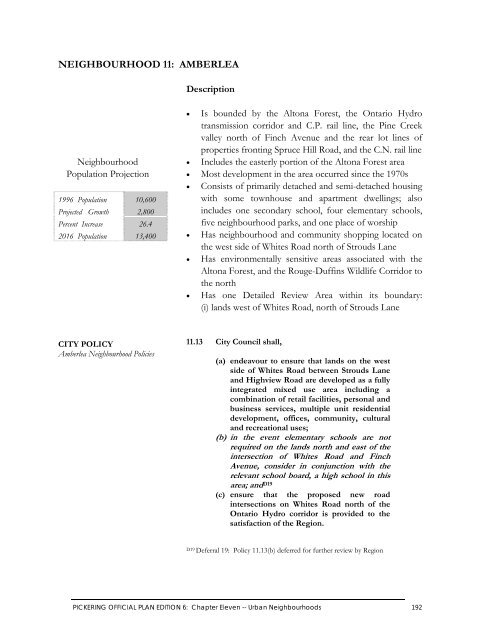
- Page 1 and 2:
P I C K E R I N G OFFICIAL PLAN
- Page 3 and 4:
PICKERING COUNCIL AT TIME OF ADOPTI
- Page 5 and 6:
P I C K E R I N G OFFICIAL PLAN DEF
- Page 7 and 8:
Outstanding Deferrals as of the Com
- Page 9 and 10:
Outstanding Deferrals as of the Com
- Page 11 and 12:
P I C K E R I N G OFFICIAL PLAN AME
- Page 13 and 14:
TABLE OF CONTENTS INTRODUCTION TO T
- Page 15 and 16:
TABLE OF CONTENTS (cont’d) PART T
- Page 17 and 18:
LIST OF TABLES Page Table 1 South P
- Page 19 and 20:
Introduction to the Official Plan
- Page 21 and 22:
What Parts of the Plan are “Offic
- Page 23 and 24:
“Frenchman’s Bay” is likely n
- Page 25 and 26:
Recent Settlement The City of Toron
- Page 27 and 28:
In building a better Pickering, we
- Page 29 and 30:
In June 1996, Pickering Council ado
- Page 31 and 32:
CHAPTER ONE -- THE GUIDING PRINCIPL
- Page 33 and 34:
Principles for Growth and Developme
- Page 35 and 36:
improving our understanding of, res
- Page 37 and 38:
CHAPTER TWO --THE PLANNING FRAMEWOR
- Page 40 and 41:
On Map 2, Watersheds, Streams and V
- Page 42 and 43:
CITY POLICY Ecological System 2.5 C
- Page 44 and 45:
CITY POLICY Urban System 2.7 City C
- Page 46 and 47:
South Pickering Urban Area By the b
- Page 48 and 49:
Seaton Urban Study Area Seaton is l
- Page 50 and 51:
CITY POLICY Input to the Seaton Pla
- Page 52 and 53:
Potential Airport Site In the early
- Page 54 and 55:
CITY POLICY Federal Airport Lands:
- Page 56 and 57:
Consistent with this vision, the Ci
- Page 58 and 59:
By 1996, approximately 4,500 people
- Page 60 and 61:
CITY POLICY Rural Employment Opport
- Page 62 and 63:
Rural Settlements Most of Pickering
- Page 73 and 74:
PART TWO Strategic Policies
- Page 75 and 76:
CITY POLICY Land Use Goal CITY POLI
- Page 77 and 78:
CITY POLICY TABLE 2: Land Use Categ
- Page 79 and 80:
(d) shall recognize that the primar
- Page 81 and 82:
CITY POLICY TABLE 3: Open Space Sys
- Page 83 and 84:
To ensure the Mixed Use Areas are a
- Page 85 and 86:
(h) for the purposes of Table 5, sh
- Page 87 and 88:
CITY POLICY TABLE 6: Mixed Use Area
- Page 89 and 90:
Employment Areas Employment opportu
- Page 91 and 92:
Urban Residential Areas Urban resid
- Page 93 and 94:
(e) prior to zoning those Low Densi
- Page 95 and 96:
3.10 City Council, (a) shall recogn
- Page 97 and 98:
(d) shall recognize the Oak Ridges
- Page 99 and 100:
CITY POLICY TABLE 12 (cont’d): Ag
- Page 101 and 102:
3.12 City Council, (a) shall recogn
- Page 103 and 104:
Potential Airport Site A Potential
- Page 105 and 106:
3.16 Section Revoked by Amendment #
- Page 107 and 108:
Exceptions Certain uses may be perm
- Page 109 and 110:
CHAPTER FOUR -- TRANSPORTATION The
- Page 111 and 112:
4.4 City Council, through its own a
- Page 113 and 114:
4.7 City Council shall endeavour to
- Page 115 and 116:
4.11 Despite section 4.10, City Cou
- Page 117 and 118:
4.15 City Council requests the Regi
- Page 119 and 120:
4.19 At level railway crossings wit
- Page 121 and 122:
CHAPTER FIVE -- ECONOMIC DEVELOPMEN
- Page 123 and 124:
(c) provide a wide range of locatio
- Page 125 and 126:
5.6 City Council shall maintain an
- Page 127 and 128:
CHAPTER SIX -- HOUSING The housing
- Page 129 and 130:
(b) encourage the affordable compon
- Page 131 and 132:
CHAPTER SEVEN -- COMMUNITY SERVICES
- Page 133 and 134:
(c) encourage all municipal departm
- Page 135 and 136:
7.8 City Council shall, (a) encoura
- Page 137 and 138:
CHAPTER EIGHT -- CULTURAL HERITAGE
- Page 139 and 140:
8.3 City Council shall, (a) assist
- Page 141 and 142:
8.8 City Council, in consultation w
- Page 143 and 144:
CHAPTER NINE -- COMMUNITY DESIGN Th
- Page 145 and 146:
(f) encourage developments that cre
- Page 147 and 148:
CHAPTER TEN -- RESOURCE MANAGEMENT
- Page 149 and 150:
(e) encouraging co-operation with p
- Page 151 and 152:
10.7 City Council recognizes that i
- Page 153 and 154:
10.11 City Council recognizes that
- Page 155 and 156:
(c) prepare, in association with th
- Page 157 and 158:
10.17 City Council recognizes that
- Page 159 and 160:
Environmental Risk Management The C
- Page 161 and 162:
(c) prohibit development on lands t
- Page 163 and 164: CHAPTER ELEVEN -- URBAN NEIGHBOURHO
- Page 165 and 166: 11.2 City Council, (a) may adopt de
- Page 168 and 169: CITY POLICY Rosebank Neighbourhood
- Page 170: NEIGHBOURHOOD 2: WEST SHORE Descrip
- Page 173 and 174: [This page intentionally left blank
- Page 176 and 177: CITY POLICY Bay Ridges Neighbourhoo
- Page 178 and 179: CITY POLICY Bay Ridges Neighbourhoo
- Page 180 and 181: CITY POLICY Bay Ridges Neighbourhoo
- Page 182: NEIGHBOURHOOD 4: BROCK INDUSTRIAL D
- Page 185 and 186: [This page intentionally left blank
- Page 188 and 189: CITY POLICY Rougemount Neighbourhoo
- Page 190: NEIGHBOURHOOD 6: WOODLANDS Descript
- Page 193 and 194: (ii) (B) all buildings to be a mini
- Page 195 and 196: (iii) require vehicular access, by
- Page 197 and 198: [This page intentionally left blank
- Page 200 and 201: CITY POLICY Dunbarton Neighbourhood
- Page 202: NEIGHBOURHOOD 8: TOWN CENTRE Descri
- Page 205 and 206: [This page intentionally left blank
- Page 208 and 209: CITY POLICY Village East Neighbourh
- Page 210: NEIGHBOURHOOD 10: HIGHBUSH Descript
- Page 213: [This page intentionally left blank
- Page 217 and 218: [This page intentionally left blank
- Page 220 and 221: CITY POLICY Liverpool Neighbourhood
- Page 222: NEIGHBOURHOOD 13: BROCK RIDGE Descr
- Page 225 and 226: [This page intentionally left blank
- Page 228 and 229: CITY POLICY Rouge Park Neighbourhoo
- Page 230: NEIGHBOURHOOD 15: DUFFIN HEIGHTS De
- Page 233 and 234: (iii) require higher intensity mult
- Page 235 and 236: (i) addresses the protection of the
- Page 237 and 238: (x) ensure that adequate utility ne
- Page 239 and 240: [This page intentionally left blank
- Page 241 and 242: General Information CITY POLICY Pre
- Page 243 and 244: [This page intentionally left blank
- Page 246 and 247: CITY POLICY Cherrywood and Area Set
- Page 248: SETTLEMENT 2: WHITEVALE Description
- Page 251 and 252: [This page intentionally left blank
- Page 254 and 255: CITY POLICY Green River Settlement
- Page 256: SETTLEMENT 4: BROUGHAM Description
- Page 259 and 260: [This page intentionally left blank
- Page 262 and 263: CITY POLICY Greenwood and Area Sett
- Page 264:
SETTLEMENT 6: STAXTON GLEN Descript
- Page 268:
SETTLEMENT 8: BARCLAY ESTATES Descr
- Page 272 and 273:
CITY POLICY Kinsale Settlement Poli
- Page 274 and 275:
SETTLEMENT 10: CLAREMONT Descriptio
- Page 276:
CITY POLICY Claremont Settlement Po
- Page 280:
SETTLEMENT 11: SPRING CREEK Descrip
- Page 284:
SETTLEMENT 13: FOREST CREEK ESTATES
- Page 287 and 288:
PART FOUR Detailed Design Considera
- Page 289 and 290:
Community Image Community image is
- Page 291 and 292:
CITY POLICY Design With Nature (con
- Page 293 and 294:
Views and Vistas Another important
- Page 295 and 296:
CITY POLICY Design of Public Open S
- Page 297 and 298:
CITY POLICY Streetscapes (cont’d)
- Page 299 and 300:
CITY POLICY Design of Buildings (co
- Page 301 and 302:
CITY POLICY Personal Security (cont
- Page 303 and 304:
Signage Good community design also
- Page 305 and 306:
CITY POLICY Pedestrian and Cycling
- Page 307 and 308:
CHAPTER FOURTEEN -- IMPLEMENTATION
- Page 309 and 310:
(e) changes to the goals, objective
- Page 311 and 312:
(e) the alignment of future roads a
- Page 313 and 314:
General Implementation This section
- Page 315 and 316:
CITY POLICY Review of Public Partic
- Page 317 and 318:
CHAPTER FIFTEEN -- DEVELOPMENT REVI
- Page 319 and 320:
Supporting Reports An application i
- Page 321 and 322:
15.5A City Council shall require th
- Page 323 and 324:
(vi) a site servicing study address
- Page 325 and 326:
15.7 When considering applications
- Page 327 and 328:
CITY POLICY Environmental Report Co
- Page 329 and 330:
CITY POLICY Noise, Vibration, Dust,
- Page 331 and 332:
Planning Tools and Controls There a
- Page 333 and 334:
CITY POLICY Bonus Zoning (cont’d)
- Page 335 and 336:
CITY POLICY Subdivision Approval (c
- Page 337 and 338:
CITY POLICY Site Plan Control (cont
- Page 339 and 340:
CITY POLICY Land Severance (cont’
- Page 341 and 342:
Enabling Policies This section of t
- Page 343 and 344:
Areas Requiring Special Policies Th
- Page 345 and 346:
CITY POLICY Flood Plain Special Pol
- Page 347 and 348:
CITY POLICY Community Improvement A
- Page 349 and 350:
Uses Requiring Special Policies The
- Page 351 and 352:
CITY POLICY Aggregate Resource Extr
- Page 353 and 354:
CITY POLICY Waste Disposal Sites 15
- Page 355 and 356:
CITY POLICY Landform Conservation A
- Page 357 and 358:
CITY POLICY Key Natural Heritage Fe
- Page 359 and 360:
CITY POLICY Key Natural Heritage Fe
- Page 361 and 362:
15.42 City Council, (a) despite any
- Page 363 and 364:
15.44 City Council shall, in order
- Page 365 and 366:
15.45 City Council, in addition to
- Page 367 and 368:
(i) the need for the project has be
- Page 369 and 370:
15.49 Within the Oak Ridges Moraine
- Page 371 and 372:
CHAPTER SIXTEEN -- MONITORING FRAME
- Page 373 and 374:
APPENDICES
- Page 375 and 376:
Appendix I (continued) Quality of L
- Page 377 and 378:
[This page intentionally left blank
- Page 379 and 380:
INDEX (cont’d) Section Number Pag
- Page 381 and 382:
INDEX (cont’d) Section Number Pag
- Page 383 and 384:
INDEX (cont’d) Section Number Pag
- Page 385 and 386:
SCHEDULES


