- Page 1 and 2: P I C K E R I N G OFFICIAL PLAN
- Page 3 and 4: PICKERING COUNCIL AT TIME OF ADOPTI
- Page 5 and 6: P I C K E R I N G OFFICIAL PLAN DEF
- Page 7 and 8: Outstanding Deferrals as of the Com
- Page 9 and 10: Outstanding Deferrals as of the Com
- Page 11 and 12: P I C K E R I N G OFFICIAL PLAN AME
- Page 13 and 14: TABLE OF CONTENTS INTRODUCTION TO T
- Page 15 and 16: TABLE OF CONTENTS (cont’d) PART T
- Page 17 and 18: LIST OF TABLES Page Table 1 South P
- Page 19 and 20: Introduction to the Official Plan
- Page 21 and 22: What Parts of the Plan are “Offic
- Page 23 and 24: “Frenchman’s Bay” is likely n
- Page 25 and 26: Recent Settlement The City of Toron
- Page 27 and 28: In building a better Pickering, we
- Page 29 and 30: In June 1996, Pickering Council ado
- Page 31 and 32: CHAPTER ONE -- THE GUIDING PRINCIPL
- Page 33 and 34: Principles for Growth and Developme
- Page 35 and 36: improving our understanding of, res
- Page 37 and 38: CHAPTER TWO --THE PLANNING FRAMEWOR
- Page 40 and 41: On Map 2, Watersheds, Streams and V
- Page 42 and 43: CITY POLICY Ecological System 2.5 C
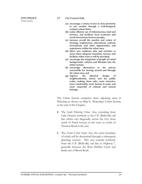
- Page 46 and 47: South Pickering Urban Area By the b
- Page 48 and 49: Seaton Urban Study Area Seaton is l
- Page 50 and 51: CITY POLICY Input to the Seaton Pla
- Page 52 and 53: Potential Airport Site In the early
- Page 54 and 55: CITY POLICY Federal Airport Lands:
- Page 56 and 57: Consistent with this vision, the Ci
- Page 58 and 59: By 1996, approximately 4,500 people
- Page 60 and 61: CITY POLICY Rural Employment Opport
- Page 62 and 63: Rural Settlements Most of Pickering
- Page 73 and 74: PART TWO Strategic Policies
- Page 75 and 76: CITY POLICY Land Use Goal CITY POLI
- Page 77 and 78: CITY POLICY TABLE 2: Land Use Categ
- Page 79 and 80: (d) shall recognize that the primar
- Page 81 and 82: CITY POLICY TABLE 3: Open Space Sys
- Page 83 and 84: To ensure the Mixed Use Areas are a
- Page 85 and 86: (h) for the purposes of Table 5, sh
- Page 87 and 88: CITY POLICY TABLE 6: Mixed Use Area
- Page 89 and 90: Employment Areas Employment opportu
- Page 91 and 92: Urban Residential Areas Urban resid
- Page 93 and 94: (e) prior to zoning those Low Densi
- Page 95 and 96:
3.10 City Council, (a) shall recogn
- Page 97 and 98:
(d) shall recognize the Oak Ridges
- Page 99 and 100:
CITY POLICY TABLE 12 (cont’d): Ag
- Page 101 and 102:
3.12 City Council, (a) shall recogn
- Page 103 and 104:
Potential Airport Site A Potential
- Page 105 and 106:
3.16 Section Revoked by Amendment #
- Page 107 and 108:
Exceptions Certain uses may be perm
- Page 109 and 110:
CHAPTER FOUR -- TRANSPORTATION The
- Page 111 and 112:
4.4 City Council, through its own a
- Page 113 and 114:
4.7 City Council shall endeavour to
- Page 115 and 116:
4.11 Despite section 4.10, City Cou
- Page 117 and 118:
4.15 City Council requests the Regi
- Page 119 and 120:
4.19 At level railway crossings wit
- Page 121 and 122:
CHAPTER FIVE -- ECONOMIC DEVELOPMEN
- Page 123 and 124:
(c) provide a wide range of locatio
- Page 125 and 126:
5.6 City Council shall maintain an
- Page 127 and 128:
CHAPTER SIX -- HOUSING The housing
- Page 129 and 130:
(b) encourage the affordable compon
- Page 131 and 132:
CHAPTER SEVEN -- COMMUNITY SERVICES
- Page 133 and 134:
(c) encourage all municipal departm
- Page 135 and 136:
7.8 City Council shall, (a) encoura
- Page 137 and 138:
CHAPTER EIGHT -- CULTURAL HERITAGE
- Page 139 and 140:
8.3 City Council shall, (a) assist
- Page 141 and 142:
8.8 City Council, in consultation w
- Page 143 and 144:
CHAPTER NINE -- COMMUNITY DESIGN Th
- Page 145 and 146:
(f) encourage developments that cre
- Page 147 and 148:
CHAPTER TEN -- RESOURCE MANAGEMENT
- Page 149 and 150:
(e) encouraging co-operation with p
- Page 151 and 152:
10.7 City Council recognizes that i
- Page 153 and 154:
10.11 City Council recognizes that
- Page 155 and 156:
(c) prepare, in association with th
- Page 157 and 158:
10.17 City Council recognizes that
- Page 159 and 160:
Environmental Risk Management The C
- Page 161 and 162:
(c) prohibit development on lands t
- Page 163 and 164:
CHAPTER ELEVEN -- URBAN NEIGHBOURHO
- Page 165 and 166:
11.2 City Council, (a) may adopt de
- Page 168 and 169:
CITY POLICY Rosebank Neighbourhood
- Page 170:
NEIGHBOURHOOD 2: WEST SHORE Descrip
- Page 173 and 174:
[This page intentionally left blank
- Page 176 and 177:
CITY POLICY Bay Ridges Neighbourhoo
- Page 178 and 179:
CITY POLICY Bay Ridges Neighbourhoo
- Page 180 and 181:
CITY POLICY Bay Ridges Neighbourhoo
- Page 182:
NEIGHBOURHOOD 4: BROCK INDUSTRIAL D
- Page 185 and 186:
[This page intentionally left blank
- Page 188 and 189:
CITY POLICY Rougemount Neighbourhoo
- Page 190:
NEIGHBOURHOOD 6: WOODLANDS Descript
- Page 193 and 194:
(ii) (B) all buildings to be a mini
- Page 195 and 196:
(iii) require vehicular access, by
- Page 197 and 198:
[This page intentionally left blank
- Page 200 and 201:
CITY POLICY Dunbarton Neighbourhood
- Page 202:
NEIGHBOURHOOD 8: TOWN CENTRE Descri
- Page 205 and 206:
[This page intentionally left blank
- Page 208 and 209:
CITY POLICY Village East Neighbourh
- Page 210:
NEIGHBOURHOOD 10: HIGHBUSH Descript
- Page 213 and 214:
[This page intentionally left blank
- Page 216 and 217:
CITY POLICY Amberlea Neighbourhood
- Page 218:
NEIGHBOURHOOD 12: LIVERPOOL Descrip
- Page 221 and 222:
[This page intentionally left blank
- Page 224 and 225:
CITY POLICY Brock Ridge Neighbourho
- Page 226:
NEIGHBOURHOOD 14: ROUGE PARK Descri
- Page 229 and 230:
[This page intentionally left blank
- Page 232 and 233:
CITY POLICY Duffin Heights Neighbou
- Page 234 and 235:
CITY POLICY Duffin Heights Neighbou
- Page 236 and 237:
CITY POLICY Duffin Heights Neighbou
- Page 238 and 239:
CITY POLICY Duffin Heights Neighbou
- Page 240 and 241:
CHAPTER TWELVE -- RURAL SETTLEMENTS
- Page 242 and 243:
Category HAMLET RESIDENTIAL CLUSTER
- Page 244:
SETTLEMENT 1: CHERRYWOOD AND AREA D
- Page 247 and 248:
[This page intentionally left blank
- Page 250 and 251:
CITY POLICY Whitevale Settlement Po
- Page 252:
SETTLEMENT 3: GREEN RIVER Descripti
- Page 255 and 256:
[This page intentionally left blank
- Page 258 and 259:
CITY POLICY Brougham Settlement Pol
- Page 260:
SETTLEMENT 5: GREENWOOD AND AREA Se
- Page 263 and 264:
[This page intentionally left blank
- Page 266:
SETTLEMENT 7: BIRCHWOOD ESTATES Des
- Page 270:
SETTLEMENT 9: KINSALE Description S
- Page 273 and 274:
[This page intentionally left blank
- Page 275 and 276:
SETTLEMENT 10: CLAREMONT (continued
- Page 279 and 280:
[This page intentionally left blank
- Page 282:
SETTLEMENT 12: BALSAM Description S
- Page 286 and 287:
[This page intentionally left blank
- Page 288 and 289:
CHAPTER THIRTEEN -- DETAILED DESIGN
- Page 290 and 291:
Corporate Initiatives The Corporati
- Page 292 and 293:
Development and Subdivision Design
- Page 294 and 295:
Design of Public Open Spaces A netw
- Page 296 and 297:
(h) endeavour to ensure that seatin
- Page 298 and 299:
Design of Buildings It is important
- Page 300 and 301:
Personal Security Another important
- Page 302 and 303:
Lighting Another important consider
- Page 304 and 305:
Pedestrian and Cycling Safety Atten
- Page 306 and 307:
PART FIVE Implementation, Developme
- Page 308 and 309:
Interpretation The Plan contains a
- Page 310 and 311:
CITY POLICY Schedule Interpretation
- Page 312 and 313:
14.4 Except for lands that are desi
- Page 314 and 315:
(d) when considering proposed amend
- Page 316 and 317:
14.14 Within the Oak Ridges Moraine
- Page 318 and 319:
Review of All Applications All appl
- Page 320 and 321:
CITY POLICY Complete Application 15
- Page 322 and 323:
CITY POLICY Required Studies for an
- Page 324 and 325:
CITY POLICY Agency Consulting on Su
- Page 326 and 327:
15.9 City Council, For development
- Page 328 and 329:
(a) require the proponents of devel
- Page 330 and 331:
15.14 Outside the Downtown Core, Ci
- Page 332 and 333:
(ii) when land assembly is required
- Page 334 and 335:
(b) shall consider a by-law to perm
- Page 336 and 337:
(d) shall ensure that applications
- Page 338 and 339:
15.25 City Council shall encourage
- Page 340 and 341:
(iv) allowing land acquisition for
- Page 342 and 343:
(c) shall not accept as parkland co
- Page 344 and 345:
15.31 In accordance with section 10
- Page 346 and 347:
(ii) an automobile service station
- Page 348 and 349:
(iii) private sanitary or water ser
- Page 350 and 351:
(ii) that as much of the site as po
- Page 352 and 353:
15.34 Despite sections 10.8 and 15.
- Page 354 and 355:
15.38 Within the urban area or with
- Page 356 and 357:
(iv) use of innovative building des
- Page 358 and 359:
(v) If Table 18 does not specify th
- Page 360 and 361:
CITY POLICY TABLE 18: Minimum areas
- Page 362 and 363:
CITY POLICY Stormwater Management -
- Page 364 and 365:
CITY POLICY Existing Uses - Oak Rid
- Page 366 and 367:
CITY POLICY Transportation, Infrast
- Page 368 and 369:
CITY POLICY Low-Intensity Recreatio
- Page 370 and 371:
[This page intentionally left blank
- Page 372 and 373:
where possible, establish appropria
- Page 374 and 375:
Appendix I Quality of Life Indicato
- Page 376 and 377:
Appendix II Guidelines on When to S
- Page 378 and 379:
INDEX
- Page 380 and 381:
INDEX (cont’d) Section Number Pag
- Page 382 and 383:
INDEX (cont’d) Section Number Pag
- Page 384 and 385:
INDEX (cont’d) Section Number Pag
- Page 386:
WHITEVALE D31 CHERRYWOOD AND AREA D


