

Maarten van Hoek The Geography of Cup-and-Ring ... - StoneWatch
Maarten van Hoek The Geography of Cup-and-Ring ... - StoneWatch
Maarten van Hoek The Geography of Cup-and-Ring ... - StoneWatch

You also want an ePaper? Increase the reach of your titles
YUMPU automatically turns print PDFs into web optimized ePapers that Google loves.
<strong>and</strong> it seems that cup-<strong>and</strong>-ring sites were not created to serve as<br />
intervisible “stepping stones” through the interior. <strong>The</strong> great majority<br />
<strong>of</strong> them are too inconspicuous <strong>and</strong> therefore difficult to locate in the<br />
l<strong>and</strong>scape, especially for strangers (as explained for the Laxe do<br />
Carrizo).<br />
And yet, cup-<strong>and</strong>-ring sites do form strings in the l<strong>and</strong>scape. <strong>The</strong>re now<br />
are two levels on which strings <strong>of</strong> rock art occur in the l<strong>and</strong>scape. On<br />
macro level, these strings clearly connect areas, like the rock art sites<br />
in the Kilmartin area link the west coast <strong>of</strong> Scotl<strong>and</strong> with the interior.<br />
On micro level however, “strings <strong>of</strong> rings” <strong>of</strong>ten lead to no place<br />
special, at least not according to our modern-minded observations. <strong>The</strong><br />
difference between these two possibilities may be illustrated by the<br />
rock art groups at Derrynablaha <strong>and</strong> Coomasaharn in Kerry, Irel<strong>and</strong>.<br />
Derrynablaha is found near an important pass connecting the south <strong>and</strong><br />
north coast <strong>of</strong> the Iveragh<br />
peninsula. Coomasaharn on the<br />
other h<strong>and</strong> is a cluster <strong>of</strong> rock<br />
art sites leading from the<br />
north coast <strong>of</strong> the Iveragh<br />
peninsula to an accumulation <strong>of</strong><br />
rock art sites near a glacial<br />
lake in the mountains; a<br />
beautiful area, but definitely<br />
<strong>of</strong>fering no through route: it<br />
truly is a geographical “dead<br />
end”. Other examples <strong>of</strong> such<br />
geographical “dead end” strings<br />
are found in Galloway (Van<br />
<strong>Hoek</strong> 1995) <strong>and</strong> on the Isle <strong>of</strong><br />
Bute, but they can also be<br />
compared with the strings <strong>of</strong><br />
rock art sites in the Tayside<br />
area, such as Tombuie <strong>and</strong><br />
Edramucky.<br />
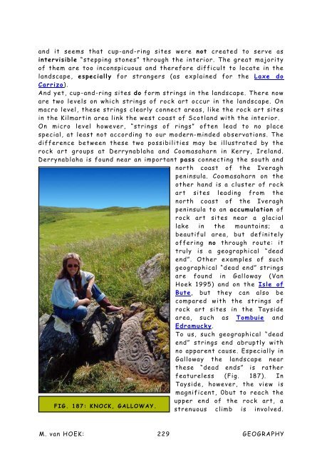
To us, such geographical “dead<br />
end” strings end abruptly with<br />
no apparent cause. Especially in<br />
Galloway the l<strong>and</strong>scape near<br />
these “dead ends” is rather<br />
featureless (Fig. 187). In<br />
Tayside, however, the view is<br />
magnificent, 0but to reach the<br />
upper end <strong>of</strong> the rock art, a<br />
FIG. 187: KNOCK, GALLOWAY.<br />
strenuous climb is involved.<br />
M. <strong>van</strong> HOEK: 229<br />
GEOGRAPHY


