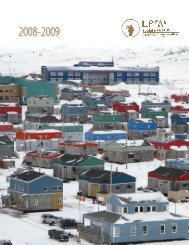
2010-2011 Makivik Annual Report

Create successful ePaper yourself
Turn your PDF publications into a flip-book with our unique Google optimized e-Paper software.
kN1axoEi3ªozJi4 W5Jp[4<br />
Cartographic Services<br />
Service de cartographie<br />
kN1axoEi3ªozJi4 W5Jp[4<br />
kN1axoEi3ªozJi4 W5Jp[4 cspn3ic˜3d6 Wsygc3t A5<br />
cs5pbsJi4 kâ5 x5yg3bsymAtqb bmguz WNcbs˜3g5<br />
x?b6 WsygcoEp4f5 wMQIscbslt4 vNbu e7mdt5noEp4fk5<br />
®NsIc3tbsJi4 WNh5bc3ik5 W5Jplt4<br />
vNbu cEbsI4ƒD8Ngi4 ®NsIc3ty[7u4. x3ÇA6 @)!@<br />
WQx3c u st9lA, WNh5†5 x3[bMsJJ5 kN[s2 kNoq8k5<br />
WQx3tyAtc3Xox5ht4 grymAt5nu8i4 kx5yi3u4 kNi4<br />
x5yymAti4 yKicDtQlQ5 kN[s2 wm3Wzî5gi4 er3bi4<br />
xtc3tyAts§5. WNh5†5 kx5y˜3ixg5 cspixc5blt9l<br />
kNi4 x5¥ymAti4, kx5yult4 si4vsyi4 bM“n4fl<br />
bf8NC5noxaymJi4 wozic3ht4 kN[s2 wkw5 WsygcqtA5<br />
kNi4 x5yymAtq8k5. x9MymJ1awAtsymJoµ5<br />
WIsA8N[c˜3g5 cEbsItA5 bfNh{[sA8Ngu s9lnos3bsymJu<br />
s4fwbsic˜Exz ß4gWE @)!@-u. ckwozoDbsJ5 Ì4f-<br />
N1z5 x9MymJ1awAtsymJi5 kxbsm5ht4 WNhAbsyJ[i3i5<br />
xg3bs˜3g5 x?b6 WsygcoE[7j5 x9MymJ1awAtsQx4vi3lt4<br />
kNÌ2 wkw5 kNi4 x5¥ymAtub kN1axos3ymAtq8k5<br />
— Ì4fx cspn3ismb WQx3tbsym5ht4 !(*) x3ÇAq5 WQx3cust9lQ5.<br />
vmNhAti4 WNhAtc3î5 kN[7u vJyK5 woz5ht4 d5ygu5bf5nsJi4<br />
WNhAtc3ik5 Ì4fx d7jxtbsymJj5 Wg5ymJi4 yM8isti4 N2XtEAtsym7mb<br />
vq3hxl4Jxul, vq3hul ƒ4Jxul. Ì4fx d5ygu5bf5nsJi4<br />
adam lewis x2<br />
Cartographic Services<br />
Cartographic Services will be conducting a Traditional Place<br />
Names Study along with the Avataq Cultural Institute as part of a<br />
Heritage Canada funded project for the Canada Interactive Fund.<br />
In early 2012, staff travelled to Nunavik communities to begin<br />
collecting information on place names with a focus on island<br />
names in the Nunavik Marine Region. Staff will be collecting and<br />
verifying place names, gathering stories and videos that relate to<br />
Nunavik traditional places. All of the data will be available on an<br />
interactive website that is scheduled for deployment in October<br />
2012. Results from this data collection initiative will be used<br />
by Avataq to publish more<br />
Nunatop Inuit Place Names<br />
Maps — a study originating<br />
in the early 1980s.<br />
Monitoring programs<br />
in Nunavik continue for the<br />
PolarView program where<br />
satellite linked weather<br />
stations are installed in<br />
Kangiqsualujjuaq, Kangirsuk<br />
and Kuujjuaq. The PolarView<br />
project team is currently compiling five years of data and will<br />
be developing a summary report and website to showcase the<br />
results of the study in the past five years. Live weather data at the<br />
monitoring sites, along with regularly updated satellite imagery<br />
can be found at http://nunavik.lakeice.ca. The Payne River site<br />
Service de cartographie<br />
Le Service de cartographie réalisera une étude sur les toponymes<br />
traditionnels en collaboration avec l’Institut culturel Avataq dans<br />
le cadre d’un projet de Patrimoine Canada financé par le Fonds<br />
interactif du Canada. Au début de 2012, des membres du service<br />
visiteront les communautés pour entreprendre la cueillette<br />
d’information en se concentrant tout d’abord sur les toponymes<br />
des îles de la région marine du Nunavik. Ils noteront et vérifieront<br />
les toponymes en plus de recueillir des récits et des vidéos sur les<br />
lieux traditionnels du Nunavik. Toutes les données seront publiées<br />
sur un site web interactif qui sera accessible à compter d’octobre<br />
2012. Avataq utilisera les résultats de<br />
cette initiative pour enrichir sa base<br />
de données Nunatop sur la toponymie<br />
inuite – un projet entrepris au début<br />
des années 1980.<br />
Les travaux de surveillance<br />
météorologique par satellite du programme<br />
PolarView se poursuivent<br />
à Kangiqsualujjuaq, Kangirsuk et<br />
Kuujjuaq. L’équipe du projet PolarView<br />
compile en ce moment les données<br />
des cinq dernières années afin de produire un rapport sommaire<br />
et présenter les résultats pour cette même période sur<br />
le Web. Des informations météorologiques en temps réel et<br />
des images satellites récentes peuvent être consultées sur le<br />
site http://nunavik.lakeice.ca. La station de la rivière Payne a<br />
mr{[4• <strong>Makivik</strong> Corporation • Société <strong>Makivik</strong><br />
119