

Tulsa Comprehensive Plan - PLANiTULSA
Tulsa Comprehensive Plan - PLANiTULSA
Tulsa Comprehensive Plan - PLANiTULSA

Create successful ePaper yourself
Turn your PDF publications into a flip-book with our unique Google optimized e-Paper software.
Transportation<br />
PArT III: tooLs For thE transportation BUiLDinG BLoCks<br />
Context sensitive solutions<br />
Properly planning for the size, alignment and character<br />
of new roads and the retrofit of existing roads to<br />
compliment sustainable land development patterns,<br />
cultural, historical and natural resources of the<br />
community is essential to realizing Our Vision for <strong>Tulsa</strong>.<br />
Currently new roads are sized based upon maximizing<br />
capacity for the automobile, aligned to meet the<br />
desired speed determined by functional classification<br />
with little regard for complimenting the adjacent land<br />
use. Requests for exceptions to the current roadway<br />
design standards from neighborhoods and developers<br />
are handled on a case by case basis and are approved at<br />
the discretion of the engineering department. Similar<br />
to the access management recommendation above,<br />
a coordinated and consistent CSS policy is needed.<br />
Appendix Transportation I offers a sample CSS policy<br />
and process.<br />
sustainable network initiative<br />
A network is a structure of streets and highways<br />
that serves and connects multiple places and people<br />
via multiple modes of travel. Sustainable networks<br />
represent a cost effective alternative to expensive grade<br />
separations, interchanges and corridors that require<br />
extensive right-of-way purchases. Sustainable networks<br />
also require local streets to be highly connected with<br />
the arterial system. This connectivity increases the<br />
opportunities for and performance of other modes of<br />
travel, such as walking, bicycling, and taking transit<br />
and improves emergency response times. Sustainable<br />
networks take a greater level of planning and creative<br />
design to build, but the result is sustainable in<br />
terms of capital and maintenance costs. Appendix<br />
Transportation III describes several planning and<br />
modeling processes that INCOG and the City should<br />
consider when performing roadway widening, grade<br />
separation, or new street classifications.<br />
Modernize street Funding<br />
Partnerships with local business groups and community<br />
organizations are essential to ensure that special<br />
streetscaping associated with context sensitive streets<br />
and other infrastructure are properly maintained.<br />
The City should institute a variety of tools to allow<br />
business and residential property owners to assist in<br />
constructing and maintaining the infrastructure and<br />
amenities developed.<br />
Local Improvement Districts (LIDs), Local Maintenance<br />
Districts, Business Improvement Districts (BIDs)<br />
and other special districts can be used to construct<br />
and maintain infrastructure such as streets, adjacent<br />
streetscaping, curb and gutters, water and drainage<br />
utility systems, sidewalks, and alleys. These programs<br />
usually require landowners to agree to a special<br />
property tax assessment, which are used to fund the<br />
improvements. <strong>Tulsa</strong> currently uses a similar approach,<br />
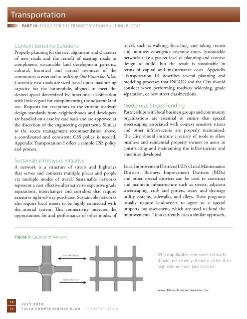
Figure 9: Capacity of network<br />
Where applicable, new street networks<br />
should use a variety of routes, rather than<br />
high-volume multi-lane facilities.<br />
Source: Kimley-Horn and Associates, Inc.<br />
TR<br />
24<br />
July 2010<br />
<strong>Tulsa</strong> comprehensive plan – transportation


