

Tulsa Comprehensive Plan - PLANiTULSA
Tulsa Comprehensive Plan - PLANiTULSA
Tulsa Comprehensive Plan - PLANiTULSA

You also want an ePaper? Increase the reach of your titles
YUMPU automatically turns print PDFs into web optimized ePapers that Google loves.
Achieving the Vision: Strategies<br />
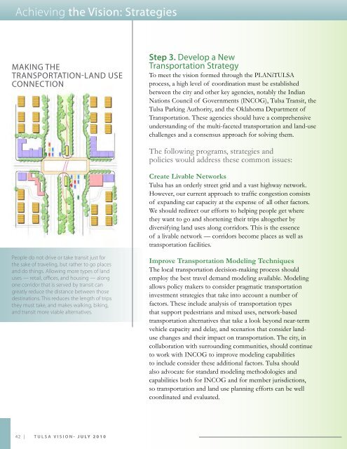
MAKiNg THE<br />
TrANSPOrTATiON-LAND USE<br />
CONNECTiON<br />
Step 3. Develop a New<br />
Transportation Strategy<br />
To meet the vision formed through the <strong>PLANiTULSA</strong><br />
process, a high level of coordination must be established<br />
between the city and other key agencies, notably the Indian<br />
Nations Council of Governments (INCOG), <strong>Tulsa</strong> Transit, the<br />
<strong>Tulsa</strong> Parking Authority, and the Oklahoma Department of<br />
Transportation. These agencies should have a comprehensive<br />
understanding of the multi-faceted transportation and land-use<br />
challenges and a consensus approach for solving them.<br />
The following programs, strategies and<br />
policies would address these common issues:<br />
Create Livable Networks<br />
<strong>Tulsa</strong> has an orderly street grid and a vast highway network.<br />
However, our current approach to traffic congestion consists<br />
of expanding car capacity at the expense of all other factors.<br />
We should redirect our efforts to helping people get where<br />
they want to go and shortening their trips altogether by<br />
diversifying land uses along corridors. This is the essence<br />
of a livable network — corridors become places as well as<br />
transportation facilities.<br />
People do not drive or take transit just for<br />
the sake of traveling, but rather to go places<br />
and do things. Allowing more types of land<br />
uses — retail, offces, and housing — along<br />
one corridor that is served by transit can<br />
greatly reduce the distance between those<br />
destinations. This reduces the length of trips<br />
they must take, and makes walking, biking,<br />
and transit more viable alternatives.<br />
Improve Transportation Modeling Techniques<br />
The local transportation decision-making process should<br />
employ the best travel demand modeling available. Modeling<br />
allows policy makers to consider pragmatic transportation<br />
investment strategies that take into account a number of<br />
factors. These include analysis of transportation types<br />
that support pedestrians and mixed uses, network-based<br />
transportation alternatives that take a look beyond near-term<br />
vehicle capacity and delay, and scenarios that consider landuse<br />
changes and their impact on transportation. The city, in<br />
collaboration with surrounding communities, should continue<br />
to work with INCOG to improve modeling capabilities<br />
to include consider these additional factors. <strong>Tulsa</strong> should<br />
also advocate for standard modeling methodologies and<br />
capabilities both for INCOG and for member jurisdictions,<br />
so transportation and land use planning efforts can be well<br />
coordinated and evaluated.<br />
42 | TULSA ViSioN- July 2010


