

Encyclopedia of Evolution.pdf - Online Reading Center
Encyclopedia of Evolution.pdf - Online Reading Center
Encyclopedia of Evolution.pdf - Online Reading Center

Create successful ePaper yourself
Turn your PDF publications into a flip-book with our unique Google optimized e-Paper software.
continental drift<br />
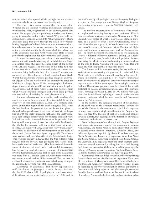
was an animal that spread widely through the world continents<br />
after the Permian extinction (see figure).<br />
There were two major reasons that the proposal <strong>of</strong><br />
Wegener and du Toit met resistance and criticism, sometimes<br />
even hostility. First, Wegener had set out to prove, rather than<br />
to test, his proposal; he was preaching it, rather than investigating<br />
it, according to his critics. Second, Wegener could not<br />
explain how continents could drift. What would move them?<br />
And how could they plow through the ocean floor without<br />
leaving huge piles <strong>of</strong> rubble? Scientists now understand that it<br />
is not the continents themselves that move, but the heavy rock<br />
<strong>of</strong> the crustal plates <strong>of</strong> the Earth, upon which the lighter rock<br />
<strong>of</strong> the continents rests (see plate tectonics). Plate tectonics<br />
provides the explanation for how continental drift occurs.<br />
A major breakthrough that enhanced the credibility <strong>of</strong><br />
continental drift was the discovery <strong>of</strong> the Mid-Atlantic Ridge,<br />
a mountain range that runs the entire length <strong>of</strong> the bottom<br />
<strong>of</strong> the Atlantic Ocean. The existence <strong>of</strong> this ridge had been<br />
known ever since it was encountered while the transatlantic<br />
cable was being laid in the late 19th century. Princeton mineralogist<br />
Harry Hess designed a depth-sounder during World<br />
War II that used sound waves to produce images <strong>of</strong> underwater<br />
objects. After the war he used this technique to study the<br />
Mid-Atlantic Ridge. By the 1950s, oceanographers had found<br />
ridges through all the world’s oceans, with a total length <strong>of</strong><br />
46,600 miles. All <strong>of</strong> these ridges looked like fractures from<br />
which volcanic material emerged, and which could produce<br />
new ocean floor, the driving force for plate tectonics.<br />
Another advancement in scientific understanding that<br />
paved the way to the acceptance <strong>of</strong> continental drift was the<br />
discovery <strong>of</strong> paleomagnetism. Molten lava contains small<br />
pieces <strong>of</strong> iron that align with the Earth’s magnetic field. When<br />
the lava hardens, the pieces <strong>of</strong> iron are locked into place. If<br />
the rock subsequently moves, the pieces <strong>of</strong> iron will no longer<br />
line up with the Earth’s magnetic field. Also, the Earth’s magnetic<br />
field changes polarity every few hundred thousand years.<br />
Volcanic rocks that hardened during an earlier period <strong>of</strong> Earth<br />
history will have pieces <strong>of</strong> iron that align with the direction<br />
that the Earth’s magnetic field had at that time, not what it<br />
is today. Geologist Fred Vine, along with Harry Hess, discovered<br />
bands <strong>of</strong> alternation <strong>of</strong> paleomagnetism in the rocks <strong>of</strong><br />
the Atlantic Ocean floor (see figure on page 87). These bands<br />
were symmetrical on either side <strong>of</strong> the Mid-Atlantic Ridge.<br />
This evidence strongly indicated that the Mid-Atlantic Ridge<br />
had, for millions <strong>of</strong> years, been producing new seafloor rock,<br />
both to the east and to the west. This demonstrated the mechanism<br />
<strong>of</strong> plate tectonics and made continental drift a compelling<br />
theory. The newly developed techniques <strong>of</strong> radiometric<br />
dating, furthermore, revealed that no part <strong>of</strong> the ocean floor<br />
was more than 175 million years old, while many continental<br />
rocks were more than three billion years old. This can now be<br />
explained because the continents have rafted along on top <strong>of</strong><br />
the continually recycling rock <strong>of</strong> the ocean floors.<br />
Acceptance <strong>of</strong> continental drift theory represented a<br />
swift revolution in geological science. Surveys indicated<br />
that by 1950 about half <strong>of</strong> geologists accepted continental<br />
drift. Almost no scientists had accepted it in 1930, and by<br />
the 1960s nearly all geologists and evolutionary biologists<br />
accepted it. One exception was George Gaylord Simpson,<br />
who resisted it for many years (see Simpson, George Gaylord).<br />
The modern reconstruction <strong>of</strong> continental drift reveals<br />
a complex and surprising history <strong>of</strong> the continents. What is<br />
now Kazakhstan was once connected to Norway and to New<br />
England. One corner <strong>of</strong> what is now Staten Island is European,<br />
as is a corner <strong>of</strong> what is now Newfoundland. What is<br />
now Massachusetts is part <strong>of</strong> the North American continent,<br />
but part <strong>of</strong> its coast is <strong>of</strong> European origin. The Scottish Highlands<br />
and Scandinavia contain much rock <strong>of</strong> American origin.<br />
The future movement <strong>of</strong> continents is no less surprising.<br />
Coastal California will move northwest, pulling Los Angeles<br />
past Oakland and, later, Seattle. Africa will push into Europe,<br />
destroying the Mediterranean and creating a mountain chain<br />
all the way to India. Australia will run into Asia. This will<br />
occur at about the pace that a fingernail grows.<br />
The further back in time one looks, the less evidence is<br />
available for reconstructing the patterns <strong>of</strong> continental drift.<br />
Most rocks over a billion years old have been destroyed by<br />
crustal movements. Geologist J. J. W. Rogers summarized<br />
available evidence and proposed that four continents merged<br />
together about a billion years ago to form a single continent,<br />
Rodinia. Others have proposed that the effect <strong>of</strong> this worldcontinent<br />
on oceanic circulation patterns caused the Earth to<br />
freeze, forming Snowball Earth. By 700 million years ago,<br />
when the Snowball was beginning to thaw, Rodinia split into<br />
separate continents, which became Laurasia and Gondwana<br />
during the Paleozoic era.<br />
In the middle <strong>of</strong> the Paleozoic era, most <strong>of</strong> the landmass<br />
<strong>of</strong> the Earth was in the Southern Hemisphere. Toward the<br />
end <strong>of</strong> the Paleozoic, the continents crashed back together,<br />
forming once again a single world-continent, Pangaea (see<br />
figure on page 88). The loss <strong>of</strong> shallow oceans, and changes<br />
in world climate, that accompanied the formation <strong>of</strong> Pangaea<br />
contributed to the Permian extinction.<br />
Near the beginning <strong>of</strong> the Mesozoic era, Pangaea began to<br />
split again, into continents roughly corresponding to modern<br />
Asia, Europe, and North America; and a cluster that was later<br />
to become South America, Antarctica, Australia, Africa, and<br />
India (see figure on page 88). By about 50 million years ago,<br />
North America and Europe were separated, as well as Africa<br />
and South America; Antarctica separated from South America<br />
and Australia. India separated from the other southern continents<br />
and moved northward, crashing into Asia and forming<br />
the Himalayan mountains. Only about a million years ago, the<br />
isthmus <strong>of</strong> Panama formed, connecting North and South America<br />
for the first time since Pangaea (see figure on page 89).<br />
Continental drift also helps to explain otherwise puzzling<br />
features about modern distributions <strong>of</strong> organisms. For example,<br />
the animals <strong>of</strong> Madagascar resembled those <strong>of</strong> India, several<br />
thousand miles away, rather than nearby Africa. This can<br />
be explained by the previous unification <strong>of</strong> these continents in<br />
Gondwanaland. Many types <strong>of</strong> trees (for example, oaks) are<br />
found in Eurasia and North America but not in the Southern<br />
Hemisphere. Apparently the first oaks evolved at a time when