- Page 3 and 4:
The National Red List 2012of Sri La
- Page 5:
Table of ContentsList of Abbreviati
- Page 8 and 9:
Red listing TeamSupervision and Gui
- Page 10 and 11:
FloraHigher PlantsParticipants of E
- Page 12 and 13:
Mr. Gayan ChathurangaMr. Imesh Nuwa
- Page 14 and 15:
AntsProf. Sriyani DiasMs. Anuradha
- Page 16 and 17:
AcknowledgementsThe National Red Li
- Page 18 and 19:
Message of the Secretary, Ministry
- Page 20 and 21:
Dung beetles 103 21Bivalves 287Gast
- Page 22 and 23:
Preparation of the 2012 Red ListDak
- Page 25 and 26:
The Taxonomy and Conservation Statu
- Page 27 and 28:
Changes in water sources, such as d
- Page 29 and 30:
Table 01: List of Dragonflies in Sr
- Page 31 and 32:
Scientific Name Common Name NSG Cri
- Page 33 and 34:
Scientific Name Common Name NSG Cri
- Page 35 and 36:
The Taxonomy and Conservation Statu
- Page 37 and 38:
fauna in the nearby forests. Furthe
- Page 39 and 40:
Table 02: List of Ants in Sri Lanka
- Page 41 and 42:
Scientific Name Common Name NCS Cri
- Page 43 and 44:
Scientific Name Common Name NCS Cri
- Page 45 and 46:
L. (Sudila) aulacophorum, and L. (E
- Page 47 and 48:
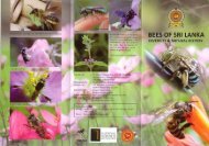
Table 03 : List of Bees in Sri Lank
- Page 49 and 50:
Scientific Name NCS CriteriaFamily:
- Page 51 and 52:
DistributionThe distribution of but
- Page 53 and 54:
Another threat of increasing import
- Page 55 and 56:
van der Poorten, G. & van der Poort
- Page 57 and 58:
Scientific Name Common Name NCS Cri
- Page 59 and 60:
Scientific Name Common Name NCS Cri
- Page 61 and 62:
Scientific Name Common Name NCS Cri
- Page 63 and 64:
Scientific Name Common Name NCS Cri
- Page 65 and 66:
Scientific Name Common Name NCS Cri
- Page 67 and 68:
DistributionSpiders are found in al
- Page 69 and 70:
Table 05: List of Spiders in Sri La
- Page 71 and 72:
Scientific Name Common Name NCS Cri
- Page 73 and 74:
Scientific Name Common Name NCS Cri
- Page 75 and 76:
Scientific Name Common Name NCS Cri
- Page 77 and 78:
Scientific Name Common Name NCS Cri
- Page 79 and 80:
Scientific Name Common Name NCS Cri
- Page 81 and 82:
Scientific Name Common Name NCS Cri
- Page 83 and 84:
ThreatsSri Lanka’s aquatic habita
- Page 85 and 86:
ReferencesADB, (2003). Sri Lanka: e
- Page 87 and 88:
Table 06: List of Freshwater Crabs
- Page 89 and 90:
The Taxonomy and Conservation Statu
- Page 91 and 92:
ConservationSurvival of highly dive
- Page 93 and 94:
Table 07: List of Land Snails in Sr
- Page 95 and 96:
Scientific Name Common Name NCS Cri
- Page 97 and 98:
Scientific Name Common Name NCS Cri
- Page 99 and 100:
Scientific Name Common Name NCS Cri
- Page 101 and 102:
The Taxonomy and Conservation Statu
- Page 103 and 104:
fish species such as Chitala chital
- Page 105 and 106:
Pethiyagoda, R., (1991). Freshwater
- Page 107 and 108:
Scientific Name Common Name NCS Cri
- Page 109 and 110:
Scientific Name Common Name NCS Cri
- Page 111 and 112:
Scientific Name Common Name NCS Cri
- Page 113 and 114:
of the original forest cover has no
- Page 115 and 116:
Pounds, J. A., Bustamante, M. R., C
- Page 117 and 118:
Scientific Name Common Name NCS Cri
- Page 119 and 120:
Scientific Name Common Name NCS Cri
- Page 121 and 122:
Scientific Name Common Name NCS Cri
- Page 123 and 124:
The Taxonomy and Conservation Statu
- Page 125 and 126:
The crocodile populations are under
- Page 127 and 128:
Murphy, J.C., and Voris, H.K. (2005
- Page 129 and 130:
Scientific Name Common Name NCS Cri
- Page 131 and 132:
Scientific Name Common Name NCS Cri
- Page 133 and 134:
Scientific Name Common Name NCS Cri
- Page 135 and 136:
Scientific Name Common Name NCS Cri
- Page 137 and 138:
Family: ViperidaeScientific Name Co
- Page 139 and 140:
espectively). Further, Halcyonidae
- Page 141 and 142:
AOU., (2005). Forty-sixth supplemen
- Page 143 and 144:
Scientific Name Common Name NCS Cri
- Page 145 and 146:
Scientific Name Common Name NCS Cri
- Page 147 and 148:
Scientific Name Common Name NCS Cri
- Page 149 and 150:
Scientific Name Common Name NCS Cri
- Page 151 and 152:
Scientific Name Common Name NCS Cri
- Page 153 and 154:
Scientific Name Common Name NCS Cri
- Page 155 and 156:
Scientific Name Common Name NCS Cri
- Page 157 and 158:
Scientific Name Common Name NCS Cri
- Page 159 and 160: Several Sri Lankan mammals are repr
- Page 161 and 162: Phillips, W. W. A., (1935). Manual
- Page 163 and 164: Scientific Name Common Name NCS Cri
- Page 165 and 166: Scientific Name Common Name NCS Cri
- Page 167 and 168: Scientific Name Common Name NCS Cri
- Page 169 and 170: Analysis of Faunal GroupsDevaka Wee
- Page 171 and 172: Table 2. The geographic distributio
- Page 173 and 174: TaxonomyThe present knowledge of pt
- Page 175 and 176: ThreatsVast majority of pteridophyt
- Page 177 and 178: Ranil, R.H.G., Pushpakumara, D.K.N.
- Page 179 and 180: Table 14: List of Pteridophytes in
- Page 181 and 182: Family/ Scientific Name Common name
- Page 183 and 184: Family/ Scientific Name Common name
- Page 185 and 186: Family/ Scientific Name Common name
- Page 187 and 188: Family/ Scientific Name Common name
- Page 189 and 190: Present Status of Dry-zone Flora in
- Page 191 and 192: Figure 1. Tropical semi-deciduous f
- Page 193 and 194: Prominent plant families in dry for
- Page 195 and 196: According to the plant records avai
- Page 197 and 198: is very likely to devastate this ec
- Page 199 and 200: Present status of Lowland Wet Zone
- Page 201 and 202: DistributionHigh degree of endemism
- Page 203 and 204: - Taxonomic research on closely rel
- Page 205 and 206: Present Status of Montane Forests i
- Page 207 and 208: Death of trees in the montane fores
- Page 209: Conservation of our mountain forest
- Page 213 and 214: category (CR); three under Endanger
- Page 215 and 216: and eutrophication (due to agricult
- Page 217 and 218: IAS list (Eichhornia crassipes). Th
- Page 219 and 220: - With the introduction of exotic a
- Page 221 and 222: Present Status of Mangroves in Sri
- Page 223 and 224: decades, aiming at increasing the u
- Page 225 and 226: Currently, at a global level, new k
- Page 227 and 228: Conservation prioritiesIn order to
- Page 229 and 230: Table 15: Summary of the Status of
- Page 231 and 232: Family EX EWCR(PE)CR EN VU NT DD LC
- Page 233 and 234: Family EX EWCR(PE)CR EN VU NT DD LC
- Page 235 and 236: Family/ Scientific Name Common name
- Page 237 and 238: Family/ Scientific Name Common name
- Page 239 and 240: Family/ Scientific Name Common name
- Page 241 and 242: Family/ Scientific Name Common name
- Page 243 and 244: Family/ Scientific Name Common name
- Page 245 and 246: Family/ Scientific Name Common name
- Page 247 and 248: Family/ Scientific Name Common name
- Page 249 and 250: Family/ Scientific Name Common name
- Page 251 and 252: Family/ Scientific Name Common name
- Page 253 and 254: Family/ Scientific Name Common name
- Page 255 and 256: Family/ Scientific Name Common name
- Page 257 and 258: Family/ Scientific Name Common name
- Page 259 and 260: Family/ Scientific Name Common name
- Page 261 and 262:
Family/ Scientific Name Common name
- Page 263 and 264:
Family/ Scientific Name Common name
- Page 265 and 266:
Family/ Scientific Name Common name
- Page 267 and 268:
Family/ Scientific Name Common name
- Page 269 and 270:
Family/ Scientific Name Common name
- Page 271 and 272:
Family/ Scientific Name Common name
- Page 273 and 274:
Family/ Scientific Name Common name
- Page 275 and 276:
Family/ Scientific Name Common name
- Page 277 and 278:
Family/ Scientific Name Common name
- Page 279 and 280:
Family/ Scientific Name Common name
- Page 281 and 282:
Family/ Scientific Name Common name
- Page 283 and 284:
Family/ Scientific Name Common name
- Page 285 and 286:
Family/ Scientific Name Common name
- Page 287 and 288:
Family/ Scientific Name Common name
- Page 289 and 290:
Family/ Scientific Name Common name
- Page 291 and 292:
Family/ Scientific Name Common name
- Page 293 and 294:
Family/ Scientific Name Common name
- Page 295 and 296:
Family/ Scientific Name Common name
- Page 297 and 298:
Family/ Scientific Name Common name
- Page 299 and 300:
Family/ Scientific Name Common name
- Page 301 and 302:
Family/ Scientific Name Common name
- Page 303 and 304:
Family/ Scientific Name Common name
- Page 305 and 306:
Family/ Scientific Name Common name
- Page 307 and 308:
Family/ Scientific Name Common name
- Page 309 and 310:
Family/ Scientific Name Common name
- Page 311 and 312:
Family/ Scientific Name Common name
- Page 313 and 314:
Family/ Scientific Name Common name
- Page 315 and 316:
Family/ Scientific Name Common name
- Page 317 and 318:
Family/ Scientific Name Common name
- Page 319 and 320:
Family/ Scientific Name Common name
- Page 321 and 322:
Family/ Scientific Name Common name
- Page 323 and 324:
Family/ Scientific Name Common name
- Page 325 and 326:
Family/ Scientific Name Common name
- Page 327 and 328:
Family/ Scientific Name Common name
- Page 329 and 330:
Family/ Scientific Name Common name
- Page 331 and 332:
Family/ Scientific Name Common name
- Page 333 and 334:
Family/ Scientific Name Common name
- Page 335 and 336:
Family/ Scientific Name Common name
- Page 337 and 338:
Family/ Scientific Name Common name
- Page 339 and 340:
Family/ Scientific Name Common name
- Page 341 and 342:
Family/ Scientific Name Common name
- Page 343 and 344:
Family/ Scientific Name Common name
- Page 345 and 346:
Family/ Scientific Name Common name
- Page 347 and 348:
Family/ Scientific Name Common name
- Page 349 and 350:
Family/ Scientific Name Common name
- Page 351 and 352:
Family/ Scientific Name Common name
- Page 353 and 354:
Family/ Scientific Name Common name
- Page 355 and 356:
Family/ Scientific Name Common name
- Page 357 and 358:
Family/ Scientific Name Common name
- Page 359 and 360:
Family/ Scientific Name Common name
- Page 361 and 362:
Family/ Scientific Name Common name
- Page 363 and 364:
Family/ Scientific Name Common name
- Page 365 and 366:
Distribution of Endemic Angiosperm
- Page 367 and 368:
PortulacaceaePotamogetonaceae (Rupp
- Page 369 and 370:
Threats to angiosperms may range fr
- Page 371 and 372:
Further, evaluation of the conserva
- Page 373 and 374:
MOE: Ministry of Environment, DWC:
- Page 375 and 376:
Area of focusResponsibleInstitution
- Page 377 and 378:
ReferencesAbayarathna, M. G. T., Ma
- Page 379 and 380:
Bingham, C. T., (1903). The fauna o
- Page 381 and 382:
de Silva, A. & Dawundasekara, D. M.
- Page 383 and 384:
Goonatilake, W. L. D. P. T. S. de A
- Page 385 and 386:
Jansen, M., (1981). Villus of the f
- Page 387 and 388:
Manamendra-Arachchi, K. & Pethiyago
- Page 389 and 390:
Pradeep, D. M. N., (2001). Amphibia
- Page 391 and 392:
Singh, L. A. K., Acharjyo, L. N. &
- Page 393 and 394:
Werner, W.L., (1986). Monaragala -
- Page 395 and 396:
1. Establishment of a national echi
- Page 397 and 398:
Provisional Checklist of Crinoidea,
- Page 399 and 400:
Provisional checklist of soft coral
- Page 401 and 402:
Extensive coral growth is limited t
- Page 403 and 404:
Rajasuriya A. 1994. Three genera an
- Page 405 and 406:
Tubastrea micrantha Ehrenberg, 1834
- Page 407 and 408:
References For Corals Recorded For
- Page 409 and 410:
Subgenera have generally not been u
- Page 411 and 412:
Family: SiliquariidaeTenagodus angu
- Page 413 and 414:
Haustellum haustellum (Linnaeus, 17
- Page 415 and 416:
Terebra subulata Linnaeus, 1767 *Te
- Page 417 and 418:
Crassostrea cf. madrasensis (Presto
- Page 419 and 420:
Paphia sp. 1*Paphia sp. 2*Paphia sp
- Page 421 and 422:
DistributionMany Marine species inc
- Page 423 and 424:
Provisional Check List of the Marin
- Page 425 and 426:
Family: ArgissidaeArgissa hamatipes
- Page 427 and 428:
Macrobrachium malcomsoni 4Expalaemo
- Page 429 and 430:
Dromia dehanni 14Sponge crabDromiop
- Page 431 and 432:
Thalamita picta 2Thalamita prymna 1
- Page 433 and 434:
References1 W. A. Herdman, 1903-6.
- Page 435 and 436:
Provisional Checklist of Marine fis
- Page 437 and 438:
ReferencesDe Bruin, G. H. P., Russe
- Page 439 and 440:
Family: AriommatidaeEcsenius bicolo
- Page 441 and 442:
Chaetodon mertensii Cuvier, 1831 5N
- Page 443 and 444:
Ctenogobiops spp. 2Pomadasys commer
- Page 445 and 446:
1, 14Lethrinus nebulosus (Forsskal,
- Page 447 and 448:
Family: NeoscopelidaeNeoscopelus ma
- Page 449 and 450:
Family: PseudochromidaeProtonibea d
- Page 451 and 452:
Family StromateidaePampus argenteus
- Page 453 and 454:
1, 17Family: GymnuridaeNarcine brun
- Page 455 and 456:
Provisional Checklist of the Leafho
- Page 457 and 458:
Tropical agricultural research. 20:
- Page 459 and 460:
Goniagnathus (T.) puntifer (Walker)
- Page 461 and 462:
Alebroides nigroscutellata (Distant
- Page 463 and 464:
Balthasar (1963), ScarabNet, the Sc
- Page 465 and 466:
Forest dwelling dung beetles may be
- Page 467 and 468:
A Provisional Checklist of Dung Bee
- Page 469 and 470:
Records of Centipede Fauna In Sri L
- Page 471 and 472:
9). Scolopendra morsitans Linnaeus,
- Page 473 and 474:
Haase E. (1887) "Die Indisch-Austra
- Page 475 and 476:
Data Deficient (DD)A taxon is Data