Note : Les documents que vous êtes sur le point de consulter ont été ...
Note : Les documents que vous êtes sur le point de consulter ont été ...
Note : Les documents que vous êtes sur le point de consulter ont été ...
You also want an ePaper? Increase the reach of your titles
YUMPU automatically turns print PDFs into web optimized ePapers that Google loves.
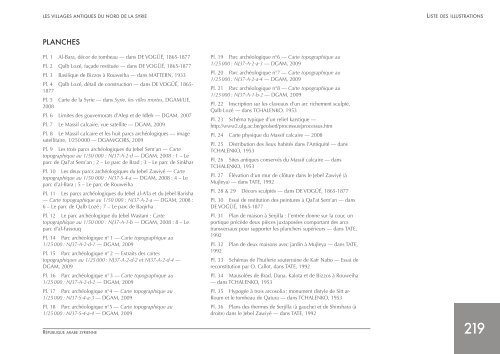
LES VILLAGES ANTIQUES DU NORD DE LA SYRIE LISTE DES ILLUSTRATIONS<br />
PLANCHES<br />
Pl. 1 Al-Bara, décor <strong>de</strong> tombeau — dans DE VOGÜÉ, 1865-1877<br />
Pl. 2 Qalb Lozé, faça<strong>de</strong> restituée — dans DE VOGÜÉ, 1865-1877<br />
Pl. 3 Basili<strong>que</strong> <strong>de</strong> Bizzos à Rouweiha — dans MATTERN, 1933<br />
Pl. 4 Qalb Lozé, détail <strong>de</strong> construction — dans DE VOGÜÉ, 1865-<br />
1877<br />
Pl. 5 Carte <strong>de</strong> la Syrie — dans Syrie, <strong>le</strong>s vil<strong>le</strong>s mortes, DGAM/UE,<br />
2008<br />
Pl. 6 Limites <strong>de</strong>s gouvernorats d’A<strong>le</strong>p et <strong>de</strong> Id<strong>le</strong>b — DGAM, 2007<br />
Pl. 7 Le Massif calcaire, vue satellite — DGAM, 2009<br />
Pl. 8 Le Massif calcaire et <strong>le</strong>s huit parcs archéologi<strong>que</strong>s — image<br />
satellitaire, 1/250 000 — DGAM/GORS, 2009<br />
Pl. 9 <strong>Les</strong> trois parcs archéologi<strong>que</strong>s du Jebel Sem’an — Carte<br />
topographi<strong>que</strong> au 1/50 000 : NJ37-A-2-d — DGAM, 2008 : 1 – Le<br />
parc <strong>de</strong> Qal’at Sem’an ; 2 – Le parc <strong>de</strong> Brad ; 3 – Le parc <strong>de</strong> Sinkhar<br />
Pl. 10 <strong>Les</strong> <strong>de</strong>ux parcs archéologi<strong>que</strong>s du Jebel Zawiyé — Carte<br />
topographi<strong>que</strong> au 1/50 000 : NI37-S-4-a — DGAM, 2008 : 4 – Le<br />
parc d’al-Bara ; 5 – Le parc <strong>de</strong> Rouweiha<br />
Pl. 11 <strong>Les</strong> parcs archéologi<strong>que</strong>s du Jebel al-A’la et du Jebel Barisha<br />
— Carte topographi<strong>que</strong> au 1/50 000 : NJ37-A-2-a — DGAM, 2008 :<br />
6 – Le parc <strong>de</strong> Qalb Lozé ; 7 – Le parc <strong>de</strong> Baqirha<br />
Pl. 12 Le parc archéologi<strong>que</strong> du Jebel Wastani : Carte<br />
topographi<strong>que</strong> au 1/50 000 : NJ37-A-1-b — DGAM, 2008 : 8 – Le<br />
parc d’al-Fassouq<br />
Pl. 14 Parc archéologi<strong>que</strong> n° 1 — Carte topographi<strong>que</strong> au<br />
1/25 000 : NJ37-A-2-d-1 — DGAM, 2009<br />
Pl. 15 Parc archéologi<strong>que</strong> n° 2 — Extraits <strong>de</strong>s cartes<br />
topographi<strong>que</strong>s au 1/25 000 : NJ37-A-2-d-2 et NJ37-A-2-d-4 —<br />
DGAM, 2009<br />
Pl. 16 Parc archéologi<strong>que</strong> n° 3 — Carte topographi<strong>que</strong> au<br />
1/25 000 : NJ37-A-2-d-2 — DGAM, 2009<br />
Pl. 17 Parc archéologi<strong>que</strong> n°4 — Carte topographi<strong>que</strong> au<br />
1/25 000 : NI37-S-4-a-3 — DGAM, 2009<br />
Pl. 18 Parc archéologi<strong>que</strong> n°5 — Carte topographi<strong>que</strong> au<br />
1/25 000 : NI37-S-4-a-4 — DGAM, 2009<br />
RÉPUbLIQUE ARAbE SYRIENNE<br />
Pl. 19 Parc archéologi<strong>que</strong> n°6 — Carte topographi<strong>que</strong> au<br />
1/25 000 : NJ37-A-2-a-3 — DGAM, 2009<br />
Pl. 20 Parc archéologi<strong>que</strong> n°7 — Carte topographi<strong>que</strong> au<br />
1/25 000 : NJ37-A-2-a-4 — DGAM, 2009<br />
Pl. 21 Parc archéologi<strong>que</strong> n°8 — Carte topographi<strong>que</strong> au<br />
1/25 000 : NJ37-A-1-b-2 — DGAM, 2009<br />
Pl. 22 Inscription <strong>sur</strong> <strong>le</strong>s claveaux d’un arc richement sculpté,<br />
Qalb Lozé — dans TCHALENKO, 1953<br />
Pl. 23 Schéma typi<strong>que</strong> d’un relief karsti<strong>que</strong> —<br />
http://www2.ulg.ac.be/geolsed/processus/processus.htm<br />
Pl. 24 Carte physi<strong>que</strong> du Massif calcaire — 2008<br />
Pl. 25 Distribution <strong>de</strong>s lieux habités dans l’Antiquité — dans<br />
TCHALENKO, 1953<br />
Pl. 26 Sites anti<strong>que</strong>s conservés du Massif calcaire — dans<br />
TCHALENKO, 1953<br />
Pl. 27 Élévation d’un mur <strong>de</strong> clôture dans <strong>le</strong> Jebel Zawiyé (à<br />
Muj<strong>le</strong>ya) — dans TATE, 1992<br />
Pl. 28 & 29 Décors sculptés — dans DE VOGÜÉ, 1865-1877<br />
Pl. 30 Essai <strong>de</strong> restitution <strong>de</strong>s peintures à Qal’at Sem’an — dans<br />
DE VOGÜÉ, 1865-1877<br />
Pl. 31 Plan <strong>de</strong> maison à Serjilla : l’entrée donne <strong>sur</strong> la cour, un<br />
porti<strong>que</strong> précè<strong>de</strong> <strong>de</strong>ux pièces juxtaposées comportant <strong>de</strong>s arcs<br />
transversaux pour supporter <strong>le</strong>s planchers supérieurs — dans TATE,<br />
1992<br />
Pl. 32 Plan <strong>de</strong> <strong>de</strong>ux maisons avec jardin à Muj<strong>le</strong>ya — dans TATE,<br />
1992<br />
Pl. 33 Schémas <strong>de</strong> l’hui<strong>le</strong>rie souterraine <strong>de</strong> Kafr Nabo — Essai <strong>de</strong><br />
reconstitution par O. Callot, dans TATE, 1992<br />
Pl. 34 Mausolées <strong>de</strong> Brad, Dana, Kalota et <strong>de</strong> Bizzos à Rouweiha<br />
— dans TCHALENKO, 1953<br />
Pl. 35 Hypogée à trois arcosolia ; monument disty<strong>le</strong> <strong>de</strong> Sitt ar-<br />
Roum et <strong>le</strong> tombeau <strong>de</strong> Qatura — dans TCHALENKO, 1953<br />
Pl. 36 Plans <strong>de</strong>s thermes <strong>de</strong> Serjilla (à gauche) et <strong>de</strong> Shinshara (à<br />
droite) dans <strong>le</strong> Jebel Zawiyé — dans TATE, 1992<br />
219


