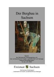
Das Döhlener Becken bei Dresden - Unbekannter Bergbau
Das Döhlener Becken bei Dresden - Unbekannter Bergbau
Das Döhlener Becken bei Dresden - Unbekannter Bergbau

Erfolgreiche ePaper selbst erstellen
Machen Sie aus Ihren PDF Publikationen ein blätterbares Flipbook mit unserer einzigartigen Google optimierten e-Paper Software.
four multiple fault systems exist that mark the south-western<br />
margin and the north-eastern slopes of internal monzonite<br />
highs.<br />
The varying thickness of strata in all formations points to a<br />
continuous tectonic activity of variable intensity. This contradicts<br />
the earlier notion of only two periods of tectonic inquiescence.<br />
Clastic dykes are a common feature in the lower<br />
half of the basin fill. They probably formed as a result of<br />
seismic events affecting poorly consolidated sediments.<br />
The dykes represent comb-like series of extension cracks<br />
mainly in coal seams that were filled from the top by soft<br />
sedimentary material or by intrusion of plastic material from<br />
the bottom. Post-depositional deformation developed due<br />
to the differential settling of coal and clastites. With increasing<br />
sediment thickness and stability, the dykes formed preferentially<br />
in zones of normal faulting that are straddling the<br />
basement ridges.<br />
The basin expanded during sedimentation in the northwestern<br />
portion by five to ten percent and in the south-eastern<br />
area by 15-30 % in north-easterly/ south-westerly direction.<br />
Numerous underground faces do not reveal any significant<br />
north-south trending faults.<br />
Hydrogeological investigations undertaken by the WISMUT<br />
GMBH in the area of the <strong>Dresden</strong>-Gittersee waste rock<br />
piles indicate that ground water is flowing on both flat lying<br />
fractures and steeply dipping, presumably northerly trending<br />
fracture zones in the Bannewitz-Hainsberg Formation.<br />
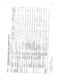
A large amount of information, part of it published for the<br />
first time, has been compiled on six maps and subsets of<br />
maps. These illustrate the<br />
• sites of 962 deep drill holes (>15 m),<br />
• underground workings including 504 shafts, among<br />
them 24 major ones, eight surface drives and 12 adits,<br />
• geology of the basement,<br />
• extent of coal seams, mined and existing, including<br />
large-scale tectonics, and<br />
• structures including the outcrops of marker horizons in<br />
the upper Niederhäslich-Schweinsdorf-Formation.<br />
The mining section starts with a discourse on the mining<br />
of various raw materials and minerals in the Döhlen Basin<br />
with coal mining representing the most significant activity.<br />
The section describes the innovative technical and operational<br />
processes of the time.<br />
A time table of the mining activities was compiled from<br />
drawings and saved documents. Occasional copper mining<br />
and, since 1558, several periods of alum and vitriol production<br />
from coal have taken place. The widespread quarrying<br />
of limestone is completely documented for the first time.<br />
Unfavourable conditions made mining difficult, for instance<br />
poor coal seams at comparatively large depth, extreme<br />
hardness of the coal, long drifts, lack of process water and<br />
conversely, large water inflow that had to be removed. As a<br />
IV<br />
consequence, mining required particularly careful planning<br />
and preparation. The challenges were overcome with great<br />
efforts and brilliant technical problem solving that are still<br />
admirable today. These are described in great detail in the<br />
chapter on mining topics.<br />
Most remarkable are the “Tiefe Weißeritz Stolln” (Deep<br />
Weisseritz water gallery) with a length of 6,630 m and the<br />
“Tiefe Elbstolln” (Deep Elbe water gallery) driven through<br />
monzonite in 1817-1837 over a distance of 5,970 m,<br />
totalling a length of 11,000 m including secondary galleries.<br />
Two mechanical power transmissions, 670 m and 420 m<br />
long, connected the mines to water wheels at the<br />
Weisseritz stream. In 1820, the first steam engine of<br />
Saxony started running at “Zauckerode Kunstschacht”. By<br />
1867 the number of steam engines had increased to 25.<br />
Without steam power, the mines on the upland of Burgk<br />
would not have been operational and the day-shafts of the<br />
“Tiefe Elbstolln” could not have been sunk.<br />
There are more historic technological developments worth<br />
mentioning: The world’s first electric mine locomotive in<br />
1882, a coal-cutting machine invented by the LILIENTHAL<br />
brothers, renowned aviation pioneers, the invention of the<br />
wet processing of coal by E. F. W. LINDIG, the coking process<br />
and the production of coal gas in the “2. Gas Plant” of<br />
Saxony that was lighting the main street of Burgk.<br />
Along with technological progress, the improvement of the<br />
road system and later the railway (1853) enhanced the economic<br />
development of the region. The coal mining gave rise<br />
to various industrial enterprises producing alum, bricks,<br />
glass, porcelain, iron, steel, and quicklime. Remarkable is<br />
also Saxony’s first coal and coke firing blast furnace.<br />
The difficult mining conditions called for meticulous planning<br />
and preparation of the mining activities. As a result,<br />
surveying became a highly developed undertaking. For the<br />
first time, HAUSSE, the most prominent surveyor in the mining<br />
area developed methods for calculating the subsidence<br />
of the surface due to mining.<br />
Despite the advanced management of the mines, some<br />
accidents occurred, such as a catastrophic mine explosion<br />
in 1869 with 276 casualties.<br />
The railway, which had been favourable for the progress of<br />
coal mining, finally became the cause for its decline as it<br />
brought access to other highly productive mining areas so<br />
that the coal output in the Döhlen Basin decreased rapidly<br />
after having reached a maximum of 660,972 t in 1900.<br />
A special chapter of this monograph is dedicated to the<br />
detailed first-time presentation of prospecting development,<br />
and output of uranium mining (1949-1989: output<br />
3,691.3 t at an average grade of 0.09 % uranium) in the<br />
Döhlen Basin.”<br />
Exploration began in 1947 by specialists of the Red Army<br />
and the Soviet Secret Service. After the confiscation of<br />
selected coal mines by the military administration in East<br />
Germany, the Soviet-owned SAG Wismut extracted uranif-